Approximate Location Map
Large Map »
Latitude: 54.2038 / 54°12'13"N
Longitude: -0.9809 / 0°58'51"W
OS Eastings: 466572
OS Northings: 479150
OS Grid: SE665791
Mapcode National: GBR PMLT.FT
Mapcode Global: WHF9Z.XL2N
Plus Code: 9C6X6239+GJ
Entry Name: The Royal Oak
Listing Date: 6 October 1987
Grade: II
Source: Historic England
Source ID: 1149674
English Heritage Legacy ID: 329314
ID on this website: 101149674
Location: Nunnington, North Yorkshire, YO62
County: North Yorkshire
District: Ryedale
Civil Parish: Nunnington
Traditional County: Yorkshire
Lieutenancy Area (Ceremonial County): North Yorkshire
Church of England Parish: Nunnington All Saints
Church of England Diocese: York
Tagged with: Architectural structure
NUNNINGTON CHURCH STREET
SE 664790
(west side)
9/51 The Royal Oak
GV II
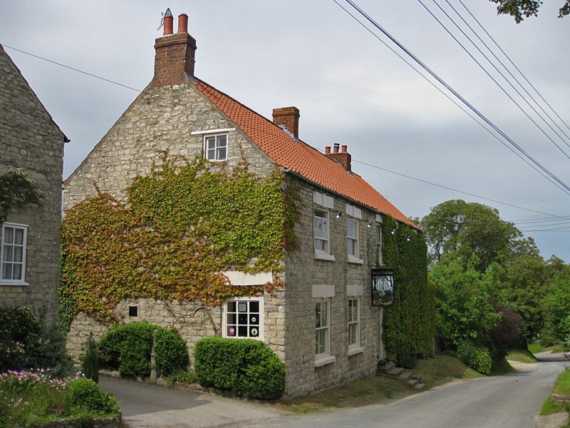
Public house. Mid-late C18 with C19 extension and alteration. Dressed
sandy limestone with pantile roof and brick stacks. 2-storey, 2-window C18
front, to left of 2-storey, 3-window extension with 1-storey, 1-window end
at far right. 4-panelled door with divided overlight in extension, to left
of two 4-pane sashes; similar windows to first floor. 1-storey end has
2-light, small-pane horizontal-sliding sash. C18 front has 4-pane sashes on
ground floor and 6-pane sashes on first floor. Painted stone sills to all
windows. Painted grooved keyblock lintels to C18 windows, and plain painted
lintels to other windows. Left end, centre right and right end stacks.
Left return: original opening now blocked by 9-pane fixed light with painted
grooved keyblock lintel on ground floor. Interior. Left end fireplace
flanked by panelled cupboard recesses with moulded surrounds. Chamfered
beam with ogee stops in room to right of door.
Listing NGR: SE6657079148
External links are from the relevant listing authority and, where applicable, Wikidata. Wikidata IDs may be related buildings as well as this specific building. If you want to add or update a link, you will need to do so by editing the Wikidata entry.


Other nearby listed buildings
