Approximate Location Map
Large Map »
Latitude: 54.0955 / 54°5'43"N
Longitude: -0.6196 / 0°37'10"W
OS Eastings: 490375
OS Northings: 467501
OS Grid: SE903675
Mapcode National: GBR SP32.NM
Mapcode Global: WHGCW.GB55
Plus Code: 9C6X39WJ+55
Entry Name: Churchyard Cross, Steps and Walled Platform Approximately 10 Metres South of the Church of St Andrew
Listing Date: 14 December 1987
Grade: II
Source: Historic England
Source ID: 1149652
English Heritage Legacy ID: 329364
ID on this website: 101149652
Location: St Andrew's Church, Kirby Grindalythe, North Yorkshire, YO17
County: North Yorkshire
District: Ryedale
Civil Parish: Kirby Grindalythe
Traditional County: Yorkshire
Lieutenancy Area (Ceremonial County): North Yorkshire
Church of England Parish: Kirby Grindalythe St Andrew
Church of England Diocese: York
Tagged with: Churchyard cross
KIRBY GRINDALYTHE VILLAGE STREET
SE 96 NW
(north side, off)
13/25 Churchyard cross, steps
and walled platform
approximately 10 metres
south of the Church of
St Andrew
GV II
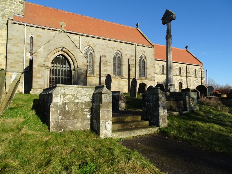
Churchyard cross, steps and walled platform. 1878; cross probably c1912.
By G E Street with cross probably by Temple Moore, for Sir Tatton Sykes.
Cross base, steps and walling dressed standstone; cross grey stone. Steps
on north and south sides of walled platform, extended to cross base to east,
and incorporating seat to west. Walls approximately 0.5 to 1 metre high
with roll-moulded sloped coping. Cruciform cross base with shallow steps
filling the angles, forming an octagon on plan. Octagonal shaft on moulded
base with broach spurs; embattled top over fleuron necking. Cross is a
crucifix beneath a gabled canopy.
Listing NGR: SE9037567501
External links are from the relevant listing authority and, where applicable, Wikidata. Wikidata IDs may be related buildings as well as this specific building. If you want to add or update a link, you will need to do so by editing the Wikidata entry.


Other nearby listed buildings
