Approximate Location Map
Large Map »
Latitude: 54.1356 / 54°8'7"N
Longitude: -1.5247 / 1°31'29"W
OS Eastings: 431149
OS Northings: 471183
OS Grid: SE311711
Mapcode National: GBR KNSM.P8
Mapcode Global: WHC7V.K94Y
Plus Code: 9C6W4FPG+64
Entry Name: 21, High Skellgate
Listing Date: 19 March 1984
Grade: II
Source: Historic England
Source ID: 1150177
English Heritage Legacy ID: 330081
ID on this website: 101150177
Location: Ripon, North Yorkshire, HG4
County: North Yorkshire
District: Harrogate
Civil Parish: Ripon
Built-Up Area: Ripon
Traditional County: Yorkshire
Lieutenancy Area (Ceremonial County): North Yorkshire
Church of England Parish: Ripon Cathedral Parish with Littlethorpe
Church of England Diocese: Leeds
Tagged with: Building
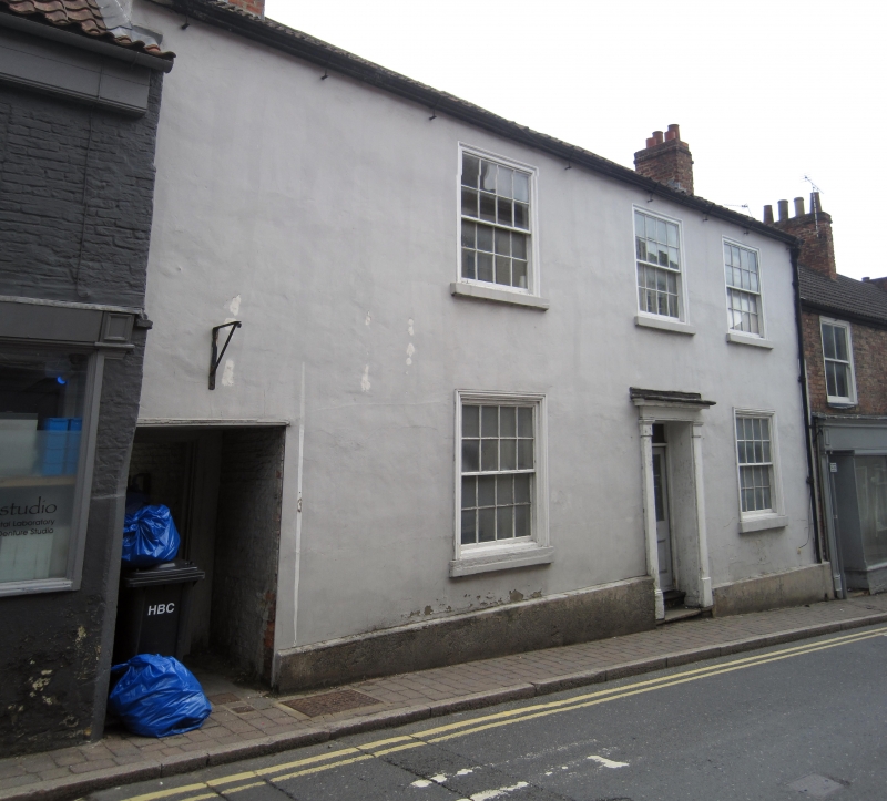
SE 3171 RIPON HIGH SKELLGATE
1/243 (east side)
No 21
GV
II
Early C19. Roughcast. Pantiled roof. Two storeys. Three bays: cased flush-framed
sashes with glazing bars. Door with oblong fanlight in wooden Tuscan surround.
Listing NGR: SE3114971183
External links are from the relevant listing authority and, where applicable, Wikidata. Wikidata IDs may be related buildings as well as this specific building. If you want to add or update a link, you will need to do so by editing the Wikidata entry.


Other nearby listed buildings
