Approximate Location Map
Large Map »
Latitude: 54.1353 / 54°8'6"N
Longitude: -1.5219 / 1°31'18"W
OS Eastings: 431333
OS Northings: 471151
OS Grid: SE313711
Mapcode National: GBR KNTM.9C
Mapcode Global: WHC7V.LBH5
Plus Code: 9C6W4FPH+46
Entry Name: The Black Friar Cafe
Listing Date: 27 May 1949
Last Amended: 19 March 1984
Grade: II
Source: Historic England
Source ID: 1243260
English Heritage Legacy ID: 330104
ID on this website: 101243260
Location: Ripon, North Yorkshire, HG4
County: North Yorkshire
District: Harrogate
Civil Parish: Ripon
Built-Up Area: Ripon
Traditional County: Yorkshire
Lieutenancy Area (Ceremonial County): North Yorkshire
Church of England Parish: Ripon Cathedral Parish with Littlethorpe
Church of England Diocese: Leeds
Tagged with: Architectural structure
SE 3171 RIPON KIRKGATE
1/11 (north side)
27.5.49
No 27
GV (The Black Friar Cafe)
(formerly listed as
Black Friar Cafe)
II
Mid-C15. Timber-framed. Stucco. Two storeys. Formerly 2 houses, although probably
nearly contemporary. West part has one bay: sliding sash with glazing bars on first
floor and mid C19 shopfront with panelled pilasters, roundels and moulded cornice.
East part has 2 bays, the eastern one with carriage entrance retaining the seating for
the hinge pin of one of the gates still in position in south-west corner, and pegs
from another seating in the south-east corner. Above the entrance 2 arch braces from
the bressummer to the principal posts are exposed: one tiny window. The other bay has
a sliding sash with glazing bars on first floor, and a sash on the ground tioor.
Two fine roof trusses (clearly numbered 2 and 3) still survive in the eastern part:
cambered tie beams, crown posts and braces from the head of the crown post to the
outer ends of the tie beam (rather similar to the exposed framing over the carriage
entrance). The western part originally had a jettied first floor (bracket for the
jetty surviving as it is cut in one with a surviving post); but the front was
subsequently extended a few feet, evidently before 1797 when it was illustrated in
J M W Turner's drawing of Kirkgate (British Museum), though without its present mid
C19 detailing.
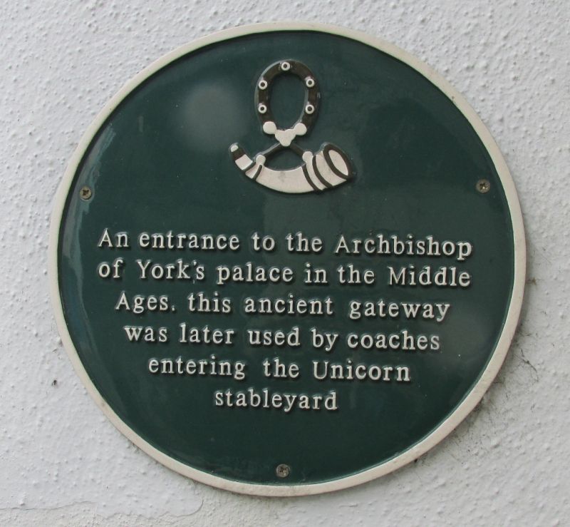
History. Built as a gatehouse, presumably to the palace of the Archbishops of York,
which almost certainly occupied the area just to the north.
Listing NGR: SE3133371151
External links are from the relevant listing authority and, where applicable, Wikidata. Wikidata IDs may be related buildings as well as this specific building. If you want to add or update a link, you will need to do so by editing the Wikidata entry.


Other nearby listed buildings
