Approximate Location Map
Large Map »
Latitude: 54.1369 / 54°8'12"N
Longitude: -1.5185 / 1°31'6"W
OS Eastings: 431559
OS Northings: 471333
OS Grid: SE315713
Mapcode National: GBR KNVL.1S
Mapcode Global: WHC7V.N84Y
Plus Code: 9C6W4FPJ+QJ
Entry Name: 28 and 29, St Marygate
Listing Date: 19 March 1984
Grade: II
Source: Historic England
Source ID: 1174656
English Heritage Legacy ID: 330213
ID on this website: 101174656
Location: Ripon, North Yorkshire, HG4
County: North Yorkshire
District: Harrogate
Civil Parish: Ripon
Built-Up Area: Ripon
Traditional County: Yorkshire
Lieutenancy Area (Ceremonial County): North Yorkshire
Church of England Parish: Ripon Cathedral Parish with Littlethorpe
Church of England Diocese: Leeds
Tagged with: Building
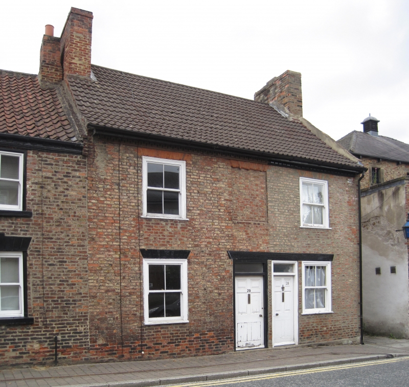
SE 3171 RIPON ST MARYGATE
1/282 (east side)
GV Nos 28 and 29
II
C18 or early C19. Brown brick. Pantiled roof. Two storey. Two bays: flush-framed
sashes with rubber voussoirs: 2 doors with 6 fielded panels each.
Listing NGR: SE3155971333
External links are from the relevant listing authority and, where applicable, Wikidata. Wikidata IDs may be related buildings as well as this specific building. If you want to add or update a link, you will need to do so by editing the Wikidata entry.


Other nearby listed buildings
