Approximate Location Map
Large Map »
Latitude: 54.1362 / 54°8'10"N
Longitude: -1.5255 / 1°31'31"W
OS Eastings: 431096
OS Northings: 471249
OS Grid: SE310712
Mapcode National: GBR KNSM.J2
Mapcode Global: WHC7V.J9RH
Plus Code: 9C6W4FPF+FQ
Entry Name: 22, Westgate
Listing Date: 6 May 1970
Grade: II
Source: Historic England
Source ID: 1150112
English Heritage Legacy ID: 330239
ID on this website: 101150112
Location: Ripon, North Yorkshire, HG4
County: North Yorkshire
District: Harrogate
Civil Parish: Ripon
Built-Up Area: Ripon
Traditional County: Yorkshire
Lieutenancy Area (Ceremonial County): North Yorkshire
Tagged with: Building
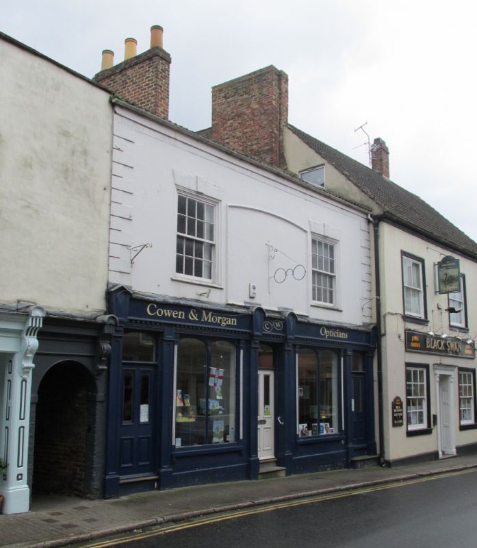
SE 3171 RIPON WESTGATE
1/112 (south side)
6.5.70
No 22
GV
- II
Probably early or mid C19, possibly earlier. Stucco. Modern pantiled roof. Two
storeys. Two bays: sashes with chanelled voussoirs. Quoins. Mid C19 shopfront with
simple pilasters, and windows with glazing bars with tiny capitals and depressed
arched heads.
Listing NGR: SE3109671249
External links are from the relevant listing authority and, where applicable, Wikidata. Wikidata IDs may be related buildings as well as this specific building. If you want to add or update a link, you will need to do so by editing the Wikidata entry.


Other nearby listed buildings
