Approximate Location Map
Large Map »
Latitude: 54.0936 / 54°5'37"N
Longitude: -1.396 / 1°23'45"W
OS Eastings: 439600
OS Northings: 466581
OS Grid: SE396665
Mapcode National: GBR LPP3.K9
Mapcode Global: WHD97.JCGM
Plus Code: 9C6W3JV3+CH
Entry Name: Kenmuir
Listing Date: 19 December 1984
Grade: II
Source: Historic England
Source ID: 1150063
English Heritage Legacy ID: 330329
ID on this website: 101150063
Location: Boroughbridge, North Yorkshire, YO51
County: North Yorkshire
District: Harrogate
Civil Parish: Boroughbridge
Built-Up Area: Boroughbridge
Traditional County: Yorkshire
Lieutenancy Area (Ceremonial County): North Yorkshire
Tagged with: Building
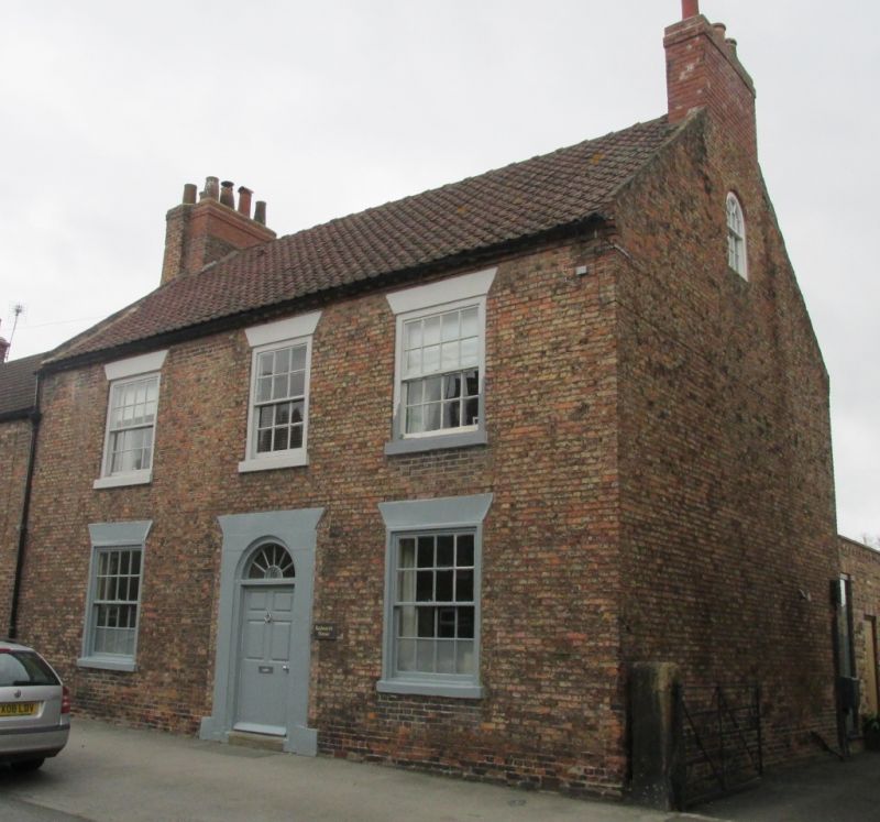
SE 3966 BOROUGHBRIDGE NEW ROW
5/62 (west side)
Kenmuir
GV
II
House. Late C18-early C19. Pinkish-brown brick. Dentilled eaves. Renewed pantile
roof with raised verges and end chimneys. 2 storeys, 3 bays. The central
round-headed entrance has a rendered surround indicating removal of a doorcase.
6-panel door, radial fanlight. 16-pane sash windows with rendered splayed lintels
and cills, in flush wood architraves.
Listing NGR: SE3960066581
External links are from the relevant listing authority and, where applicable, Wikidata. Wikidata IDs may be related buildings as well as this specific building. If you want to add or update a link, you will need to do so by editing the Wikidata entry.


Other nearby listed buildings
