Approximate Location Map
Large Map »
Latitude: 54.189 / 54°11'20"N
Longitude: -1.5033 / 1°30'11"W
OS Eastings: 432511
OS Northings: 477137
OS Grid: SE325771
Mapcode National: GBR KNY0.B4
Mapcode Global: WHC7G.WZB1
Plus Code: 9C6W5FQW+HM
Entry Name: Sundial in Graveyard of Church of St Mary, Approximately 6 Metres South of South Door
Listing Date: 27 September 1984
Grade: II
Source: Historic England
Source ID: 1315546
English Heritage Legacy ID: 330455
ID on this website: 101315546
Location: St Mary's Church, Wath, North Yorkshire, HG4
County: North Yorkshire
District: Harrogate
Civil Parish: Wath
Traditional County: Yorkshire
Lieutenancy Area (Ceremonial County): North Yorkshire
Tagged with: Sundial
SE 37 NW WATH MAIN STREET
(east end)
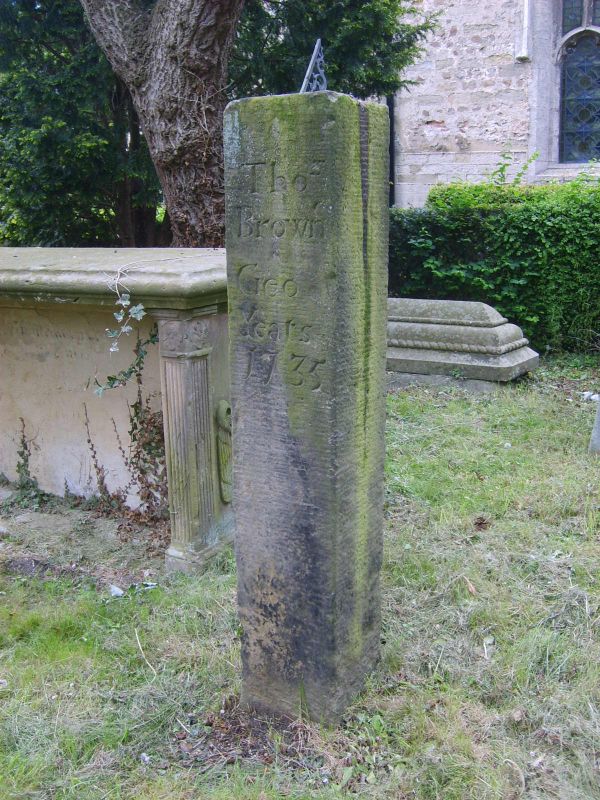
2/79 Sundial in graveyard
of Church of St Mary,
approximately
6 metres south of
south door
-
- II
Sundial on base. 1735. Stone with brass sundial. Pier approximately
1 metre high with inscription: 'Thos / Browne / Geo / Yeats / 1735'.
Listing NGR: SE3251177137
External links are from the relevant listing authority and, where applicable, Wikidata. Wikidata IDs may be related buildings as well as this specific building. If you want to add or update a link, you will need to do so by editing the Wikidata entry.


Other nearby listed buildings
