Approximate Location Map
Large Map »
Latitude: 54.009 / 54°0'32"N
Longitude: -1.4724 / 1°28'20"W
OS Eastings: 434672
OS Northings: 457128
OS Grid: SE346571
Mapcode National: GBR LQ52.0M
Mapcode Global: WHD9L.CH2G
Plus Code: 9C6W2G5H+J2
Entry Name: The Hermitage
Listing Date: 5 February 1952
Grade: II
Source: Historic England
Source ID: 1315620
English Heritage Legacy ID: 330874
ID on this website: 101315620
Location: Tentergate, North Yorkshire, HG5
County: North Yorkshire
District: Harrogate
Civil Parish: Knaresborough
Built-Up Area: Knaresborough
Traditional County: Yorkshire
Lieutenancy Area (Ceremonial County): North Yorkshire
Church of England Parish: Knaresborough
Church of England Diocese: Leeds
Tagged with: Architectural structure
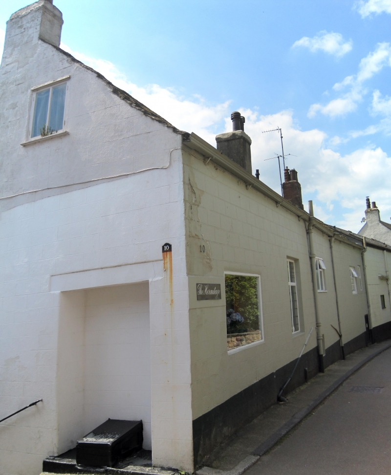
SE 3457 KNARESBOROUGH WATERSIDE
(south side)
6/204 No 10 (The Hermitage)
5.2.52
GV II
Two houses, now guesthouse and cafe. Late C18 with mid C20 restoration when
rendering applied. Main range, right: rendered brick, Westmorland slate
roof. 2 storeys, 3 bays. Central C20 glazed door with overlight. Flanking
and first-floor sashes with glazing bars in flush wood architraves. Range
to left: rendering over stone, roof of small Westmorland slates. Central
C20 glazed door under C20 porch, sashes with glazing bars in flush wood
architraves right and first-floor centre. C20 casement window, left. 3-
light dormer window in centre of roof. Ridge stacks at each gable end, and
between the 2 ranges. The routeway from the river edge to Water Bag Bank
and so to Kirkgate originally passed through the grounds of this house.
Listing NGR: SE3467257128
External links are from the relevant listing authority and, where applicable, Wikidata. Wikidata IDs may be related buildings as well as this specific building. If you want to add or update a link, you will need to do so by editing the Wikidata entry.


Other nearby listed buildings
