Approximate Location Map
Large Map »
Latitude: 53.9154 / 53°54'55"N
Longitude: -1.7314 / 1°43'52"W
OS Eastings: 417741
OS Northings: 446613
OS Grid: SE177466
Mapcode National: GBR JRB5.Y6
Mapcode Global: WHC8Q.CVS8
Plus Code: 9C5WW789+4C
Entry Name: Sundial Approximately 5 Metres South of Church of All Saints
Listing Date: 14 July 1987
Grade: II
Source: Historic England
Source ID: 1174898
English Heritage Legacy ID: 331497
ID on this website: 101174898
Location: All Saint's Church, Weston, North Yorkshire, LS21
County: North Yorkshire
District: Harrogate
Civil Parish: Weston
Traditional County: Yorkshire
Lieutenancy Area (Ceremonial County): North Yorkshire
Church of England Parish: Weston All Saints
Church of England Diocese: Leeds
Tagged with: Sundial
WESTON WESTON PARK
SE 14 NE
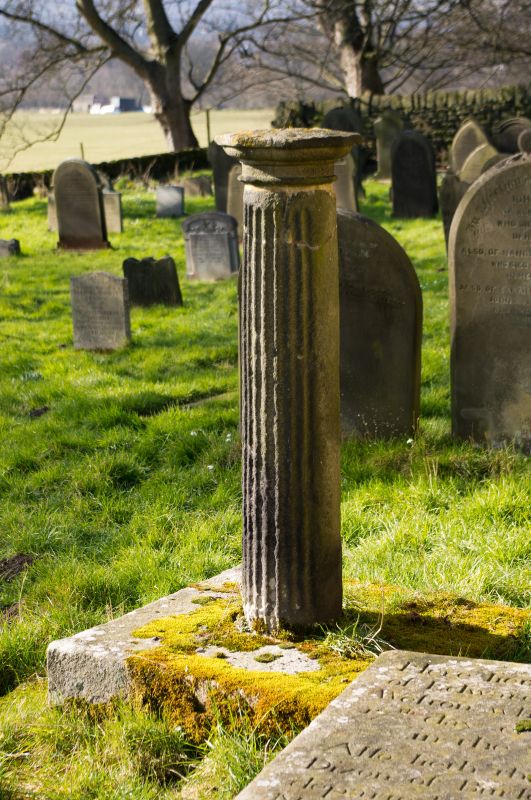
10/102 Sundial approximately 5
metres south of Church of
All Saints
GV II
Sundial. Probably late C18. Gritstone. Square base, the shaft a deeply
fluted column, the moulded cap broken at time of resurvey.
Listing NGR: SE1774146613
External links are from the relevant listing authority and, where applicable, Wikidata. Wikidata IDs may be related buildings as well as this specific building. If you want to add or update a link, you will need to do so by editing the Wikidata entry.


Other nearby listed buildings
