Approximate Location Map
Large Map »
Latitude: 51.4461 / 51°26'45"N
Longitude: -2.8584 / 2°51'30"W
OS Eastings: 340440
OS Northings: 172245
OS Grid: ST404722
Mapcode National: GBR JC.N3QP
Mapcode Global: VH7C1.DXQB
Plus Code: 9C3VC4WR+CJ
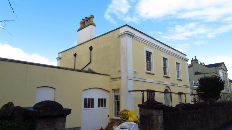
Entry Name: Cambrian House
Listing Date: 22 January 1976
Grade: II
Source: Historic England
Source ID: 1129745
English Heritage Legacy ID: 33154
ID on this website: 101129745
Location: Walton St Mary, North Somerset, BS21
County: North Somerset
Civil Parish: Clevedon
Built-Up Area: Clevedon
Traditional County: Somerset
Lieutenancy Area (Ceremonial County): Somerset
Tagged with: House
WELLINGTON TERRACE
1.
5121
(West Side)
No 10
(Cambrian House)
ST 4072 2/134
II
2.
2 storey mid C19 house with roughcast front showing incised masonry. Cornice
removed. Blocking course. End pilasters. 3 windows in plain surrounds, sashes,
glazing bars. Trellised glazed verandah to ground floor. Round-headed entrance.
Listing NGR: ST4044072245
External links are from the relevant listing authority and, where applicable, Wikidata. Wikidata IDs may be related buildings as well as this specific building. If you want to add or update a link, you will need to do so by editing the Wikidata entry.


Other nearby listed buildings
