Approximate Location Map
Large Map »
Latitude: 51.3179 / 51°19'4"N
Longitude: -2.9676 / 2°58'3"W
OS Eastings: 332663
OS Northings: 158084
OS Grid: ST326580
Mapcode National: GBR J7.X67W
Mapcode Global: VH7CR.J40K
Plus Code: 9C3V829J+4X
Entry Name: The Devils Bridge
Listing Date: 19 May 1983
Grade: II
Source: Historic England
Source ID: 1129720
English Heritage Legacy ID: 33187
ID on this website: 101129720
Location: Oldmixon, North Somerset, BS24
County: North Somerset
Civil Parish: Weston-super-Mare
Built-Up Area: Weston-Super-Mare
Traditional County: Somerset
Lieutenancy Area (Ceremonial County): Somerset
Tagged with: Road bridge
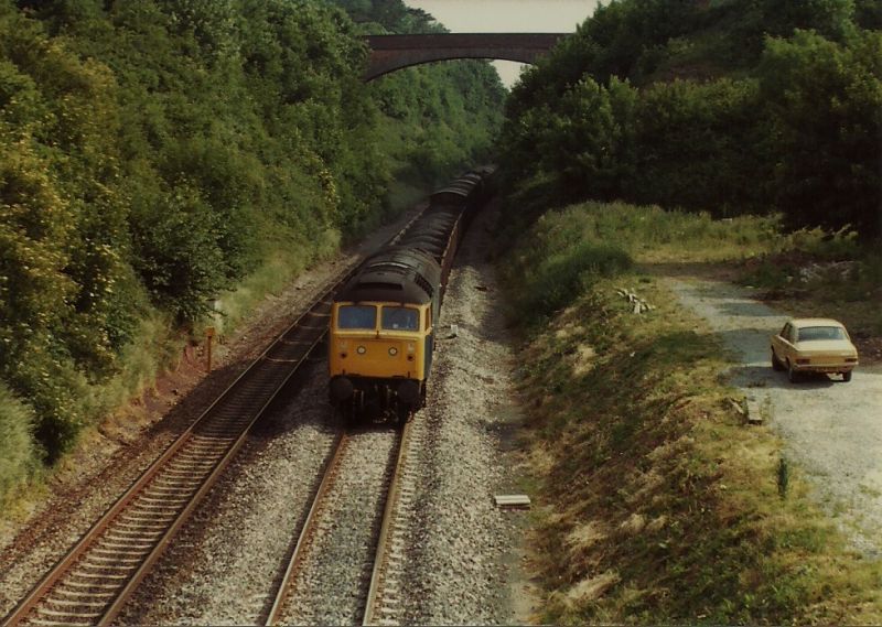
BLEADON HILL
1.
5121 Oldmixon
The Devil's Bridge
ST 35 NW 3/60
II
2.
1841. Single span brick bridge, with ashlar coussoirs. Parapets renewed. Spans
former Bristol and Exeter railway line - I K Brunel was engineer to the company.
Said to be highest single span bridge on the line.
Listing NGR: ST3266358084
External links are from the relevant listing authority and, where applicable, Wikidata. Wikidata IDs may be related buildings as well as this specific building. If you want to add or update a link, you will need to do so by editing the Wikidata entry.


Other nearby listed buildings
