Approximate Location Map
Large Map »
Latitude: 54.4827 / 54°28'57"N
Longitude: -1.3849 / 1°23'5"W
OS Eastings: 439949
OS Northings: 509882
OS Grid: NZ399098
Mapcode National: GBR LJRL.ZV
Mapcode Global: WHD79.PLQB
Plus Code: 9C6WFJM8+32
Entry Name: Worsall Bridge
Listing Date: 4 August 1983
Grade: II
Source: Historic England
Source ID: 1150276
English Heritage Legacy ID: 331916
ID on this website: 101150276
Location: Low Worsall, North Yorkshire, TS15
County: North Yorkshire
District: Hambleton
Civil Parish: Low Worsall
Traditional County: Yorkshire
Lieutenancy Area (Ceremonial County): North Yorkshire
Church of England Parish: Kirk Levington St Martin
Church of England Diocese: York
Tagged with: Bridge
NZ 30 NE LOW WORSALL WORSALL ROAD
5/24
Worsall Bridge
II
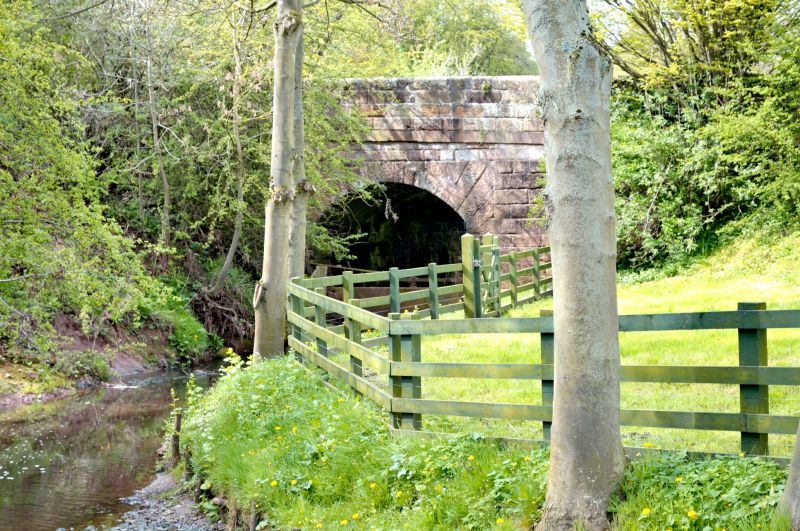
Early C19 appearance. Large coursed dressed stone. Single round arch with cut
voussoirs extending to fill a recessed square panel headed by parapet band. Rounded
parapet coping. Very slightly splayed ends finishing in domed round piers.
Listing NGR: NZ3994909882
External links are from the relevant listing authority and, where applicable, Wikidata. Wikidata IDs may be related buildings as well as this specific building. If you want to add or update a link, you will need to do so by editing the Wikidata entry.


Other nearby listed buildings
