Approximate Location Map
Large Map »
Latitude: 51.3519 / 51°21'6"N
Longitude: -2.9793 / 2°58'45"W
OS Eastings: 331895
OS Northings: 161884
OS Grid: ST318618
Mapcode National: GBR J6.V396
Mapcode Global: VH7CK.98SY
Plus Code: 9C3V922C+Q7
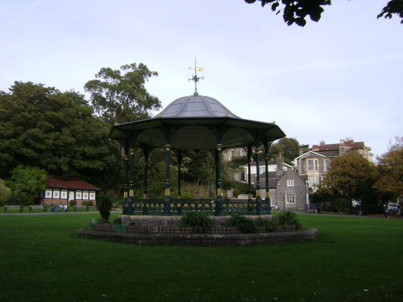
Entry Name: The Bandstand
Listing Date: 19 May 1983
Grade: II
Source: Historic England
Source ID: 1137611
English Heritage Legacy ID: 33200
ID on this website: 101137611
Location: Grove Park, Weston-super-Mare, North Somerset, BS23
County: North Somerset
Civil Parish: Weston-super-Mare
Built-Up Area: Weston-Super-Mare
Traditional County: Somerset
Lieutenancy Area (Ceremonial County): Somerset
Tagged with: Architectural structure
GROVE PARK
1.
5121
The Bandstand
ST 3161 NE 9/16
II
2.
Late C19. Victorian bandstand. Ironwork by Hill Bros, Sun Foundry, Alloa. Cast
iron columns and balustrade on rubble base. Ogee lead roof with overhanging eaves
on cast iron brackets. Weather vane.
Listing NGR: ST3189561884
External links are from the relevant listing authority and, where applicable, Wikidata. Wikidata IDs may be related buildings as well as this specific building. If you want to add or update a link, you will need to do so by editing the Wikidata entry.


Other nearby listed buildings
