Approximate Location Map
Large Map »
Latitude: 54.4878 / 54°29'15"N
Longitude: -1.1936 / 1°11'36"W
OS Eastings: 452337
OS Northings: 510569
OS Grid: NZ523105
Mapcode National: GBR NJ3K.D1
Mapcode Global: WHD7D.MGTG
Plus Code: 9C6WFRQ4+4H
Entry Name: Tanton Bridge
Listing Date: 4 August 1983
Grade: II
Source: Historic England
Source ID: 1315447
English Heritage Legacy ID: 332015
ID on this website: 101315447
Location: Tanton, North Yorkshire, TS9
County: North Yorkshire
District: Hambleton
Civil Parish: Stokesley
Traditional County: Yorkshire
Lieutenancy Area (Ceremonial County): North Yorkshire
Church of England Parish: Stokesley with Seamer-in-Cleveland
Church of England Diocese: York
Tagged with: Bridge
NZ 51 SW STOKESLEY TANTON
4/153
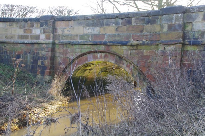
Tanton Bridge
II
C18. Ashlar sandstone. Single round arch with impost band and dripmould is flanked
by pilaster buttresses running up through abacus and frieze to top of parapet which
has ogee ridged coping. All 4 ends have curved splay.
Listing NGR: NZ5233710569
External links are from the relevant listing authority and, where applicable, Wikidata. Wikidata IDs may be related buildings as well as this specific building. If you want to add or update a link, you will need to do so by editing the Wikidata entry.


Other nearby listed buildings
