Approximate Location Map
Large Map »
Latitude: 54.0206 / 54°1'14"N
Longitude: -1.2146 / 1°12'52"W
OS Eastings: 451555
OS Northings: 458578
OS Grid: SE515585
Mapcode National: GBR MPYY.VG
Mapcode Global: WHD9Q.96VJ
Plus Code: 9C6W2QCP+75
Entry Name: The Brew House
Listing Date: 28 February 1952
Grade: II
Source: Historic England
Source ID: 1151000
English Heritage Legacy ID: 332096
ID on this website: 101151000
Location: North Yorkshire, YO30
County: North Yorkshire
District: Hambleton
Civil Parish: Beningbrough
Traditional County: Yorkshire
Lieutenancy Area (Ceremonial County): North Yorkshire
Church of England Parish: Newton-on-Ouse All Saints
Church of England Diocese: York
Tagged with: House
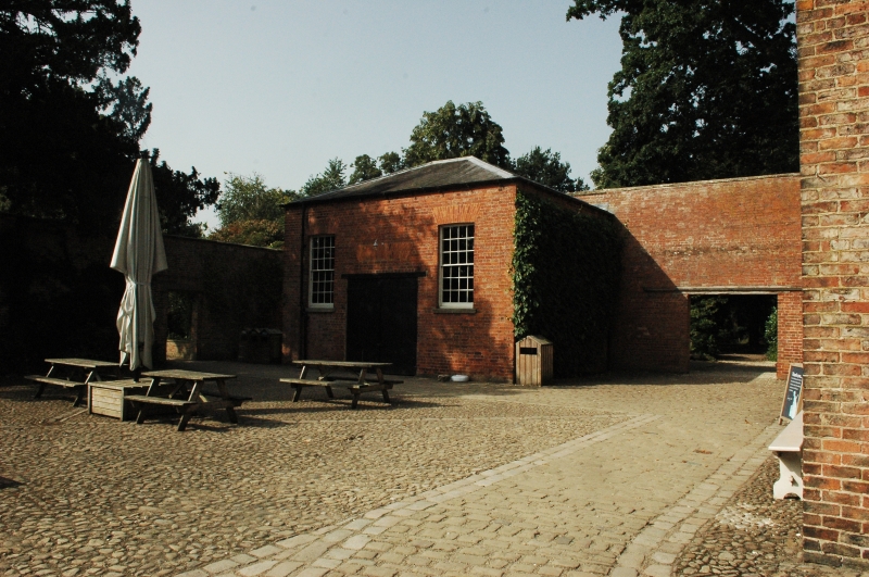
SE 55 NW BENINGBROUGH BENINGBROUGH HALL
4/3 The Brew House
28.2.52
GV II
Brew house, now outbuilding. Mid C18. Orange brick in English bond, Welsh slate
roof. 2 storeys, 3 bays. Central doorway, now lowered and with wider garage doors,
flanked by 24-pane sashes with stone cills, all openings under cambered gauged brick
arches. Hipped roof.
Listing NGR: SE5155558578
External links are from the relevant listing authority and, where applicable, Wikidata. Wikidata IDs may be related buildings as well as this specific building. If you want to add or update a link, you will need to do so by editing the Wikidata entry.


Other nearby listed buildings
