Approximate Location Map
Large Map »
Latitude: 54.2968 / 54°17'48"N
Longitude: -1.3435 / 1°20'36"W
OS Eastings: 442824
OS Northings: 489220
OS Grid: SE428892
Mapcode National: GBR ML1R.XG
Mapcode Global: WHD89.B8GB
Plus Code: 9C6W7MW4+PH
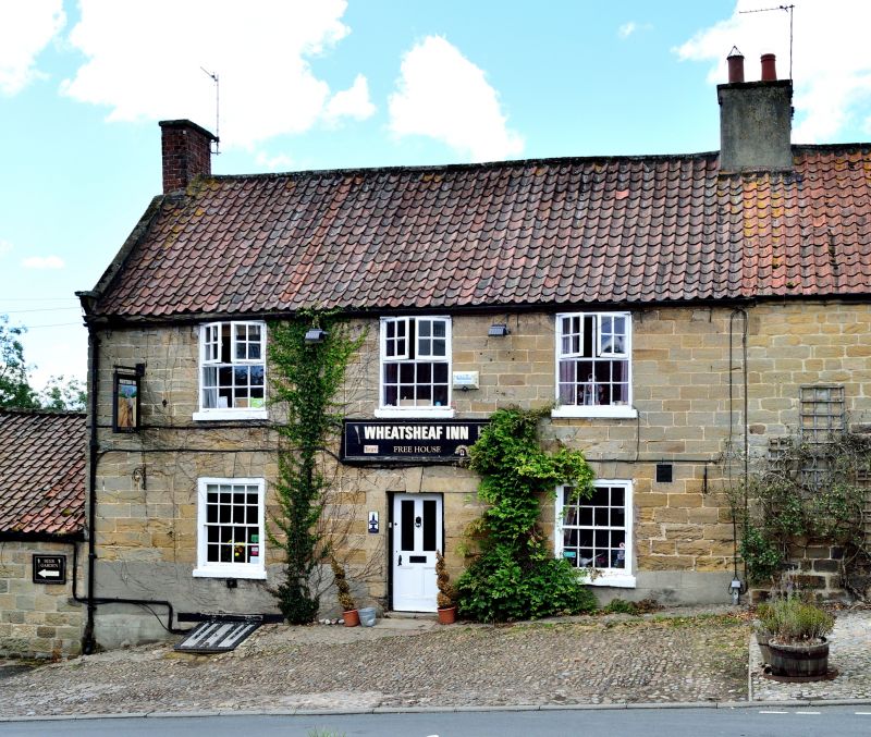
Entry Name: Wheatsheaf Inn
Listing Date: 31 March 1970
Grade: II
Source: Historic England
Source ID: 1150981
English Heritage Legacy ID: 332151
Also known as: The Wheatsheaf Inn, Thirsk
ID on this website: 101150981
SE 48 NW BORROWBY CHESTNUT BANK
(west side)
9/14 Wheatsheaf Inn
31.3.70
GV II
Public house. Mid to late C18. Coursed squared stone, pantile roof. 2
storeys, 3 bays. Central half-glazed door in quoined surround with keyed
lintel flanked by 16-pane sashes having keyed flat arches and stone sills.
First floor: 16-pane casements with stone sills, shaped kneeler, stone
coping to left. End stacks.
Listing NGR: SE4282489220
External links are from the relevant listing authority and, where applicable, Wikidata. Wikidata IDs may be related buildings as well as this specific building. If you want to add or update a link, you will need to do so by editing the Wikidata entry.


Other nearby listed buildings
