Approximate Location Map
Large Map »
Latitude: 54.4239 / 54°25'25"N
Longitude: -1.3637 / 1°21'49"W
OS Eastings: 441385
OS Northings: 503347
OS Grid: NZ413033
Mapcode National: GBR LKX8.KY
Mapcode Global: WHD7Q.02XD
Plus Code: 9C6WCJFP+HG
Entry Name: West Rounton Bridge
Listing Date: 31 March 1970
Grade: II
Source: Historic England
Source ID: 1315159
English Heritage Legacy ID: 332419
ID on this website: 101315159
Location: West Rounton, North Yorkshire, DL6
County: North Yorkshire
District: Hambleton
Civil Parish: West Rounton
Traditional County: Yorkshire
Lieutenancy Area (Ceremonial County): North Yorkshire
Church of England Parish: West Rounton St Oswald
Church of England Diocese: York
Tagged with: Bridge
NORTH YORKSHIRE
HAMBLETON
5337
NZ 40 SW WEST ROUNTON
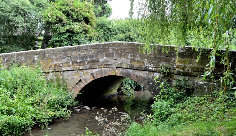
8/55 West Rounton Bridge
31.3.70
- II
Bridge. Late C18. Ashlar. 1 segmental arch with voussoirs and raised
keystone, plain band and parapets with chamfered copings, rising to a point
over the arch.
Listing NGR: NZ4138503347
External links are from the relevant listing authority and, where applicable, Wikidata. Wikidata IDs may be related buildings as well as this specific building. If you want to add or update a link, you will need to do so by editing the Wikidata entry.


Other nearby listed buildings
