Approximate Location Map
Large Map »
Latitude: 54.3689 / 54°22'8"N
Longitude: -1.2988 / 1°17'55"W
OS Eastings: 445657
OS Northings: 497270
OS Grid: SE456972
Mapcode National: GBR MKCX.MM
Mapcode Global: WHD7Y.0GT2
Plus Code: 9C6W9P92+HF
Entry Name: 16, North End
Listing Date: 11 December 1987
Grade: II
Source: Historic England
Source ID: 1150855
English Heritage Legacy ID: 332456
ID on this website: 101150855
Location: Osmotherley, North Yorkshire, DL6
County: North Yorkshire
District: Hambleton
Civil Parish: Osmotherley
Built-Up Area: Osmotherley
Traditional County: Yorkshire
Lieutenancy Area (Ceremonial County): North Yorkshire
Church of England Parish: Osmotherley St Peter
Church of England Diocese: York
Tagged with: Building
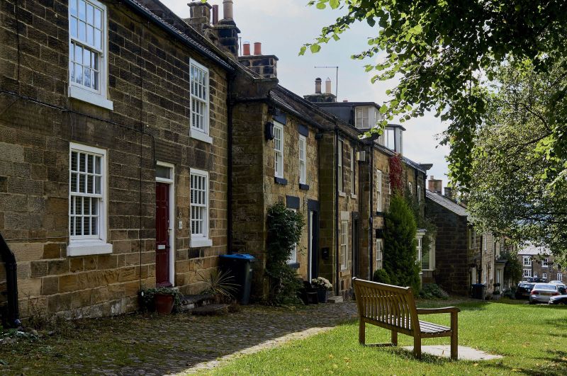
OSMOTHERLEY NORTH END
SE 4497-4597
(east side)
6/23 No 16
GV II
2 houses, now one. Early C19. Ashlar, machine tile roof. 2 storeys, 2
bays. 3 steps up to slightly off-centre 6-panel door with overlight and
plain lintel. Blocked door to far left. All windows are 16-pane sashes
with stone sills and plain lintels, ridge stack.
Listing NGR: SE4565797270
External links are from the relevant listing authority and, where applicable, Wikidata. Wikidata IDs may be related buildings as well as this specific building. If you want to add or update a link, you will need to do so by editing the Wikidata entry.


Other nearby listed buildings
