Approximate Location Map
Large Map »
Latitude: 54.2133 / 54°12'47"N
Longitude: -1.57 / 1°34'12"W
OS Eastings: 428139
OS Northings: 479815
OS Grid: SE281798
Mapcode National: GBR KMGQ.WD
Mapcode Global: WHC7F.VCKC
Plus Code: 9C6W6C7H+8X
Entry Name: Camp House
Listing Date: 30 August 1988
Grade: II
Source: Historic England
Source ID: 1150781
English Heritage Legacy ID: 332697
ID on this website: 101150781
Location: Nosterfield, North Yorkshire, DL8
County: North Yorkshire
District: Hambleton
Civil Parish: West Tanfield
Traditional County: Yorkshire
Lieutenancy Area (Ceremonial County): North Yorkshire
Tagged with: House
SE 27 NE
8/67
WEST TANFIELD
MOOR LANE
(north side, off)
Nosterfield
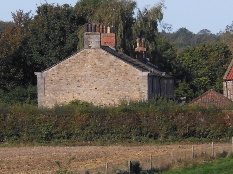
Camp House
II
Farmhouse. Early C19. Coursed squared stone with stone dressings and
graduated stone slate roof. 2 storeys, 3 bays, with lower later C19 wing
set back to left return of no special interest. Quoins. Off-centre 6-panel
door with overlight below flat stone arch. All windows are 16-pane sashes
with stone sills and flat stone arches. Shaped kneelers, stone coping. End
stacks.
Listing NGR: SE2813979815
External links are from the relevant listing authority and, where applicable, Wikidata. Wikidata IDs may be related buildings as well as this specific building. If you want to add or update a link, you will need to do so by editing the Wikidata entry.


Other nearby listed buildings
