Approximate Location Map
Large Map »
Latitude: 51.3057 / 51°18'20"N
Longitude: -2.8448 / 2°50'41"W
OS Eastings: 341203
OS Northings: 156620
OS Grid: ST412566
Mapcode National: GBR JD.XTB9
Mapcode Global: VH7CT.MFXY
Plus Code: 9C3V8544+73
Entry Name: Old Vicarage
Listing Date: 21 April 1983
Grade: II
Source: Historic England
Source ID: 1320685
English Heritage Legacy ID: 33277
ID on this website: 101320685
Location: North Somerset, BS25
County: North Somerset
Civil Parish: Winscombe and Sandford
Built-Up Area: Winscombe
Traditional County: Somerset
Lieutenancy Area (Ceremonial County): Somerset
Tagged with: Clergy house
ST 45 NW WINSCOMBE CHURCH LANE
Winscombe
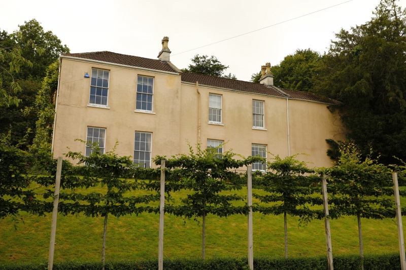
3/9 Old Vicarage
G.V. II
House, formerly vicarage. Early C.19. Rendered, concrete tiles. 2 storeys.
3 bays. Principal (east) elevation has 2 blind bays and slightly recessed
central bay. Centre porch has pair of Greek Doric columns in antis under frieze;
porch now glazed. First floor has one 12-light glazing bar sash. Return
elevations of 4 bays with similar windows. Service wings beyond.
Listing NGR: ST4120456622
External links are from the relevant listing authority and, where applicable, Wikidata. Wikidata IDs may be related buildings as well as this specific building. If you want to add or update a link, you will need to do so by editing the Wikidata entry.


Other nearby listed buildings
