Approximate Location Map
Large Map »
Latitude: 54.2099 / 54°12'35"N
Longitude: -1.214 / 1°12'50"W
OS Eastings: 451363
OS Northings: 479638
OS Grid: SE513796
Mapcode National: GBR MMYR.ZM
Mapcode Global: WHD8R.BF5Y
Plus Code: 9C6W6Q5P+XC
Entry Name: Mounting Block Approximately 6 Metres to South West of South Gate to Church of St Mary
Listing Date: 20 December 1988
Grade: II
Source: Historic England
Source ID: 1315229
English Heritage Legacy ID: 332879
ID on this website: 101315229
Location: Kilburn, North Yorkshire, YO61
County: North Yorkshire
District: Hambleton
Civil Parish: Kilburn High and Low
Traditional County: Yorkshire
Lieutenancy Area (Ceremonial County): North Yorkshire
Tagged with: Mounting block
SE 5179
8/21
KILBURN HIGH AND LOW
LOW KILBURN
(east side)
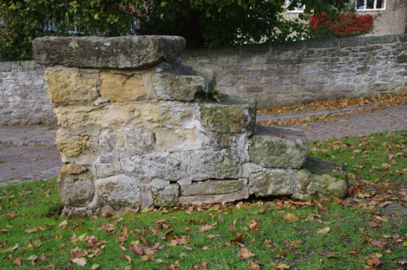
Mounting block approximately 6 metres to south west of south gate to Church of St Mary
GV
II
Mounting block. Probably C18. Coursed squared stone. Four steps up to platform,
the lower one detached.
Listing NGR: SE5136379638
External links are from the relevant listing authority and, where applicable, Wikidata. Wikidata IDs may be related buildings as well as this specific building. If you want to add or update a link, you will need to do so by editing the Wikidata entry.


Other nearby listed buildings
