Approximate Location Map
Large Map »
Latitude: 54.4983 / 54°29'54"N
Longitude: -1.0647 / 1°3'52"W
OS Eastings: 460674
OS Northings: 511848
OS Grid: NZ606118
Mapcode National: GBR PJ0F.97
Mapcode Global: WHF8L.M67B
Plus Code: 9C6WFWXP+84
Entry Name: Percy Rigg Cross
Listing Date: 5 May 1952
Grade: II
Source: Historic England
Source ID: 1151362
English Heritage Legacy ID: 333195
ID on this website: 101151362
Location: North Yorkshire, TS9
County: North Yorkshire
District: Hambleton
Civil Parish: Kildale
Traditional County: Yorkshire
Lieutenancy Area (Ceremonial County): North Yorkshire
Church of England Parish: Kildale St Cuthbert
Church of England Diocese: York
KILDALE PERCY CROSS RIGG
NZ 61 SW
North-east side
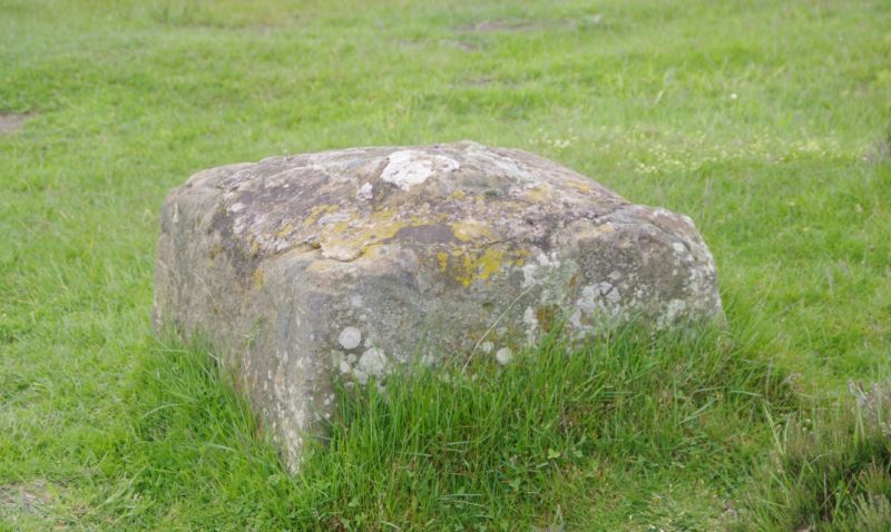
Percy Rigg Cross
2/136
5/5/52
II
Cross base. Probably medieval. Tooled stone. Square on plan with
chamfered sides. Benchmark on west side. Central socket with cut-
off section of stone shaft.
Listing NGR: NZ6067411848
External links are from the relevant listing authority and, where applicable, Wikidata. Wikidata IDs may be related buildings as well as this specific building. If you want to add or update a link, you will need to do so by editing the Wikidata entry.


Other nearby listed buildings
