Approximate Location Map
Large Map »
Latitude: 54.2222 / 54°13'20"N
Longitude: -1.3374 / 1°20'14"W
OS Eastings: 443301
OS Northings: 480927
OS Grid: SE433809
Mapcode National: GBR MM3M.86
Mapcode Global: WHD8P.F4DH
Plus Code: 9C6W6MC7+V3
Entry Name: Garden Wall Adjoining Number 172 to South
Listing Date: 20 June 1966
Last Amended: 15 June 1984
Grade: II
Source: Historic England
Source ID: 1151350
English Heritage Legacy ID: 333272
ID on this website: 101151350
Location: Sowerby, North Yorkshire, YO7
County: North Yorkshire
District: Hambleton
Civil Parish: Sowerby
Built-Up Area: Thirsk
Traditional County: Yorkshire
Lieutenancy Area (Ceremonial County): North Yorkshire
Tagged with: Wall
This list entry was subject to a Minor Amendment on 25/03/2014
SE 48 SW
2/33
SOWERBY,
FRONT STREET (west side),
Garden wall adjoining No 172 to south
(Formerly listed under MAIN STREET.
Previously listed under Front Street)
20.6.66
II
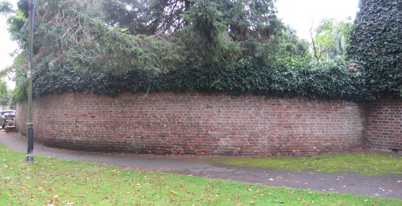
Garden wall with quadrant north section. C19. Reddish-brown brick with flat stone
coping.
Listing NGR: SE4330180927
External links are from the relevant listing authority and, where applicable, Wikidata. Wikidata IDs may be related buildings as well as this specific building. If you want to add or update a link, you will need to do so by editing the Wikidata entry.


Other nearby listed buildings
