Approximate Location Map
Large Map »
Latitude: 54.2175 / 54°13'2"N
Longitude: -1.3536 / 1°21'12"W
OS Eastings: 442250
OS Northings: 480388
OS Grid: SE422803
Mapcode National: GBR LMZN.RX
Mapcode Global: WHD8P.58P4
Plus Code: 9C6W6J8W+XH
Entry Name: Mile Post East of Cocked Hat Farm
Listing Date: 15 June 1984
Grade: II
Source: Historic England
Source ID: 1314928
English Heritage Legacy ID: 333276
ID on this website: 101314928
Location: North Yorkshire, YO7
County: North Yorkshire
District: Hambleton
Civil Parish: Sowerby
Traditional County: Yorkshire
Lieutenancy Area (Ceremonial County): North Yorkshire
Tagged with: Milestone
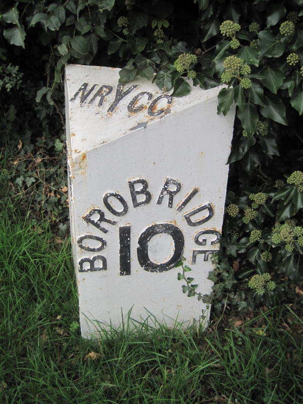
SE 48 SW SOWERBY TOPCLIFFE ROAD
2/37 (west side)
Mile past east of Cocked
Hat Farm
II
Mile post. Mid 19. Cast iron painted white with lettering in relief in black.
Triangular plan, inscriptions as follows:- To upper face NR Y CC; to south face THIRSK
1; to north face BOROBRIDGE 10. Manufactured locally at Norby foundry.
Listing NGR: SE4225080387
External links are from the relevant listing authority and, where applicable, Wikidata. Wikidata IDs may be related buildings as well as this specific building. If you want to add or update a link, you will need to do so by editing the Wikidata entry.


Other nearby listed buildings
