Approximate Location Map
Large Map »
Latitude: 54.2335 / 54°14'0"N
Longitude: -1.3451 / 1°20'42"W
OS Eastings: 442787
OS Northings: 482171
OS Grid: SE427821
Mapcode National: GBR MM1H.L5
Mapcode Global: WHD8H.9VQF
Plus Code: 9C6W6MM3+9X
Entry Name: 29, Kirkgate
Listing Date: 20 June 1966
Grade: II
Source: Historic England
Source ID: 1190506
English Heritage Legacy ID: 333292
ID on this website: 101190506
Location: Thirsk, North Yorkshire, YO7
County: North Yorkshire
District: Hambleton
Civil Parish: Thirsk
Built-Up Area: Thirsk
Traditional County: Yorkshire
Lieutenancy Area (Ceremonial County): North Yorkshire
Tagged with: Building
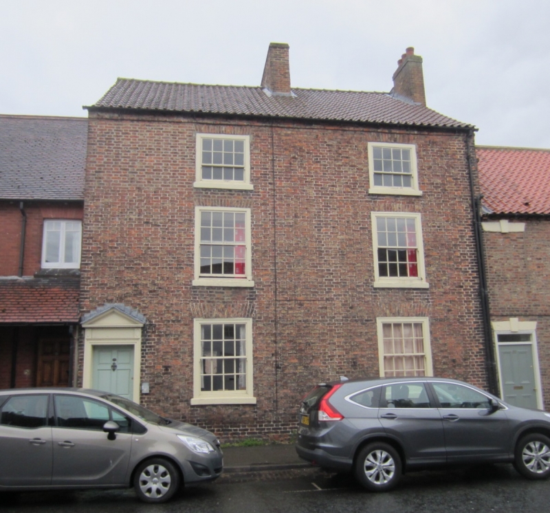
SE 4282 THIRSK KIRKGATE
6/52 (west side)
20.6.66
No 29
GV
II
House. Late C18. Local reddish-brown brick. Pantile roof. 3 storeys, 2 bays.
Entrance to left has a panelled door in wooden doorcase with moulded architrave and
triangular pediment. Sash windows with glazing bars in flush wooden cases with gauged
brick heads and stucco cills.
Listing NGR: SE4278482171
External links are from the relevant listing authority and, where applicable, Wikidata. Wikidata IDs may be related buildings as well as this specific building. If you want to add or update a link, you will need to do so by editing the Wikidata entry.


Other nearby listed buildings
