Approximate Location Map
Large Map »
Latitude: 54.2341 / 54°14'2"N
Longitude: -1.3457 / 1°20'44"W
OS Eastings: 442748
OS Northings: 482245
OS Grid: SE427822
Mapcode National: GBR MM1G.GY
Mapcode Global: WHD8H.9TGX
Plus Code: 9C6W6MM3+MP
Entry Name: Brick Wall to South of Thirsk Hall Forecourt
Listing Date: 15 June 1984
Grade: II
Source: Historic England
Source ID: 1190549
English Heritage Legacy ID: 333297
ID on this website: 101190549
Location: Norby, North Yorkshire, YO7
County: North Yorkshire
District: Hambleton
Civil Parish: Thirsk
Built-Up Area: Thirsk
Traditional County: Yorkshire
Lieutenancy Area (Ceremonial County): North Yorkshire
Tagged with: Wall
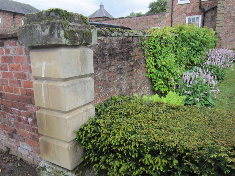
SE 4282 THIRSK KIRKGATE
6/100 (west side)
GV Brick wall to south of
Thirsk Hall forecourt
II
Wall of forecourt of Thirsk Hall to the south. Lat C18. Reddish-brown local brick in
garden-wall bond. Stone coping. Aproximately 6 ft high terminating in a 6 ft
rusticated stone pier. Group value with Thirsk Hall.
Listing NGR: SE4274582244
External links are from the relevant listing authority and, where applicable, Wikidata. Wikidata IDs may be related buildings as well as this specific building. If you want to add or update a link, you will need to do so by editing the Wikidata entry.


Other nearby listed buildings
