Approximate Location Map
Large Map »
Latitude: 54.2319 / 54°13'55"N
Longitude: -1.3436 / 1°20'36"W
OS Eastings: 442886
OS Northings: 482003
OS Grid: SE428820
Mapcode National: GBR MM1H.XQ
Mapcode Global: WHD8H.BWFL
Plus Code: 9C6W6MJ4+QH
Entry Name: 10 and 12, Market Place
Listing Date: 15 June 1984
Grade: II
Source: Historic England
Source ID: 1151323
English Heritage Legacy ID: 333309
ID on this website: 101151323
Location: Thirsk, North Yorkshire, YO7
County: North Yorkshire
District: Hambleton
Civil Parish: Thirsk
Built-Up Area: Thirsk
Traditional County: Yorkshire
Lieutenancy Area (Ceremonial County): North Yorkshire
Tagged with: Building
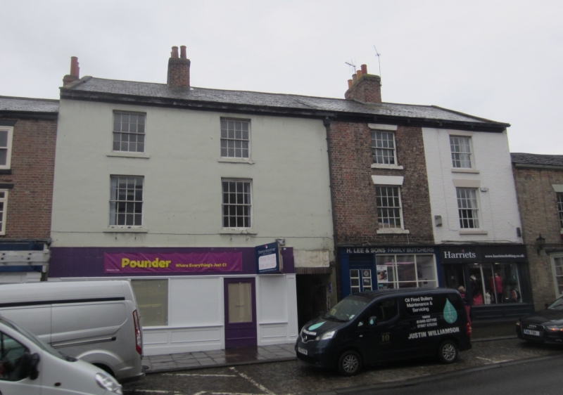
SE 4281 THIRSK MARKET PLACE
6/68 (south side)
Nos 10 and 12
II
Pair of houses with shop fronts. Late C18 or early C19. Brown brick. Slate roof. 3
storeys, each 2 bays. Good C19 shop fronts with pilasters, No 12 altered by C20
glazing. Upper floor windows are 16-pane sashes with stucco cills and heads.
Listing NGR: SE4288682003
External links are from the relevant listing authority and, where applicable, Wikidata. Wikidata IDs may be related buildings as well as this specific building. If you want to add or update a link, you will need to do so by editing the Wikidata entry.


Other nearby listed buildings
