Approximate Location Map
Large Map »
Latitude: 54.2329 / 54°13'58"N
Longitude: -1.3431 / 1°20'35"W
OS Eastings: 442915
OS Northings: 482114
OS Grid: SE429821
Mapcode National: GBR MM2H.0C
Mapcode Global: WHD8H.BVNT
Plus Code: 9C6W6MM4+5Q
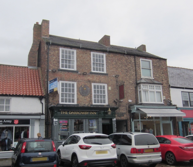
Entry Name: The Red Bear Public House
Listing Date: 15 June 1984
Grade: II
Source: Historic England
Source ID: 1151327
English Heritage Legacy ID: 333318
Also known as: Red Bear
The Red Bear, Thirsk
ID on this website: 101151327
Location: Thirsk, North Yorkshire, YO7
County: North Yorkshire
District: Hambleton
Civil Parish: Thirsk
Built-Up Area: Thirsk
Traditional County: Yorkshire
Lieutenancy Area (Ceremonial County): North Yorkshire
Tagged with: Pub
SE 4282-4382 THIRSK MARKET PLACE
6/77 (north side)
GV No 47 (The Red Bear
Public House)
II
Public House. Early C19. Brown brick, C20 slate roof. 3 storeys, 2 bays. c1970
front to ground floor. Passageway to right. Above, 16-pane sash windows in flush
moulded cases. Included mainly for group considerations.
Listing NGR: SE4291582114
External links are from the relevant listing authority and, where applicable, Wikidata. Wikidata IDs may be related buildings as well as this specific building. If you want to add or update a link, you will need to do so by editing the Wikidata entry.


Other nearby listed buildings
