Approximate Location Map
Large Map »
Latitude: 54.2352 / 54°14'6"N
Longitude: -1.341 / 1°20'27"W
OS Eastings: 443050
OS Northings: 482371
OS Grid: SE430823
Mapcode National: GBR MM2G.GK
Mapcode Global: WHD8H.CTN2
Plus Code: 9C6W6MP5+3H
Entry Name: 38, St James' Green
Listing Date: 15 June 1984
Grade: II
Source: Historic England
Source ID: 1190970
English Heritage Legacy ID: 333336
ID on this website: 101190970
Location: Thirsk, North Yorkshire, YO7
County: North Yorkshire
District: Hambleton
Civil Parish: Thirsk
Built-Up Area: Thirsk
Traditional County: Yorkshire
Lieutenancy Area (Ceremonial County): North Yorkshire
Tagged with: Building
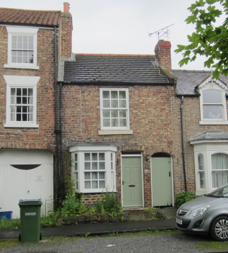
SE 4382 THIRSK ST JAMES' GREEN
7/94 (west side)
No 38
II
House. Early C19. Brown locally made brick. Slate roof. 2 storeys. Panelled door
with fanlight. Canted bay with sashes with glazing bars. A single window above of the
same type. Carriageway to right.
Listing NGR: SE4305082371
External links are from the relevant listing authority and, where applicable, Wikidata. Wikidata IDs may be related buildings as well as this specific building. If you want to add or update a link, you will need to do so by editing the Wikidata entry.


Other nearby listed buildings
