Approximate Location Map
Large Map »
Latitude: 51.4116 / 51°24'41"N
Longitude: -2.7301 / 2°43'48"W
OS Eastings: 349315
OS Northings: 168318
OS Grid: ST493683
Mapcode National: GBR JJ.QCZ8
Mapcode Global: VH88R.MSJ7
Plus Code: 9C3VC769+JW
Entry Name: Churchyard Cross, in the Churchyard and to the South of St Andrew's Church
Listing Date: 16 March 1984
Grade: II
Source: Historic England
Source ID: 1320634
English Heritage Legacy ID: 33418
ID on this website: 101320634
Location: St Andrew's Church, Church Town, North Somerset, BS48
County: North Somerset
Civil Parish: Backwell
Built-Up Area: Backwell
Traditional County: Somerset
Lieutenancy Area (Ceremonial County): Somerset
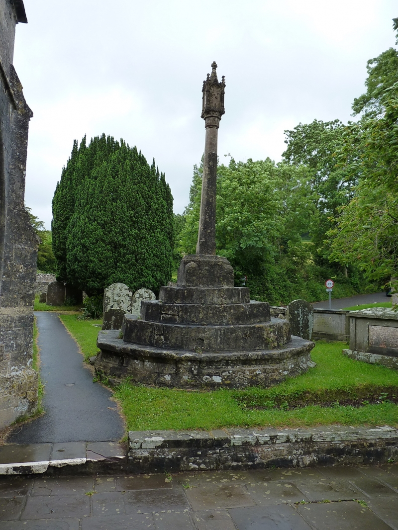
ST 46 NE BACKWELL CHURCH LANE (north-west side)
6/22 Churchyard Cross, in the
Churchyard and to the south of
G.V. St. Andrew's Church
II
Churchyard cross. C15. Ashlar. Octagonal base of 4 steps on a moulded plinth.
Square plinth to the shaft, stop-chamfered in the upper part. Tapering octagonal
shaft with a head of 1962.
Listing NGR: ST4931768321
External links are from the relevant listing authority and, where applicable, Wikidata. Wikidata IDs may be related buildings as well as this specific building. If you want to add or update a link, you will need to do so by editing the Wikidata entry.


Other nearby listed buildings
