Approximate Location Map
Large Map »
Latitude: 53.4325 / 53°25'57"N
Longitude: -1.1092 / 1°6'32"W
OS Eastings: 459283
OS Northings: 393229
OS Grid: SK592932
Mapcode National: GBR NXPR.N8
Mapcode Global: WHDDG.YZ0F
Plus Code: 9C5WCVMR+28
Entry Name: 1 and 1A, Castlegate
Listing Date: 22 January 1981
Grade: II
Source: Historic England
Source ID: 1314751
English Heritage Legacy ID: 334303
ID on this website: 101314751
Location: Tickhill, Doncaster, South Yorkshire, DN11
County: Doncaster
Civil Parish: Tickhill
Built-Up Area: Tickhill
Traditional County: Yorkshire
Lieutenancy Area (Ceremonial County): South Yorkshire
Church of England Parish: Tickhill St Mary
Church of England Diocese: Sheffield
Tagged with: Building
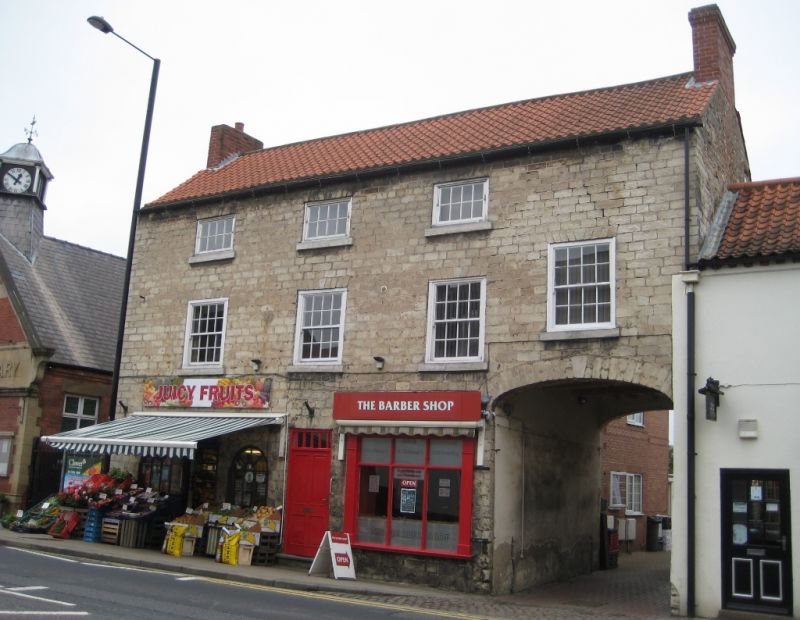
CASTLEGATE
1. (east side)
5096 -----------
Nos 1 and 1A
SK 5993 2/6
II GV
2.
C18 or early C19. Hammer dressed limestone. Pantiled roof. Three storeys.
Four bays: cased sashes with glazing bars. Segment-headed carriage arch at
south end.
Listing NGR: SK5928393228
External links are from the relevant listing authority and, where applicable, Wikidata. Wikidata IDs may be related buildings as well as this specific building. If you want to add or update a link, you will need to do so by editing the Wikidata entry.


Other nearby listed buildings
