Approximate Location Map
Large Map »
Latitude: 53.4308 / 53°25'50"N
Longitude: -1.1091 / 1°6'32"W
OS Eastings: 459290
OS Northings: 393039
OS Grid: SK592930
Mapcode National: GBR NXPR.PW
Mapcode Global: WHDDN.Y116
Plus Code: 9C5WCVJR+89
Entry Name: 39 and 41, Castlegate
Listing Date: 22 January 1981
Grade: II
Source: Historic England
Source ID: 1151752
English Heritage Legacy ID: 334311
ID on this website: 101151752
Location: Tickhill, Doncaster, South Yorkshire, DN11
County: Doncaster
Civil Parish: Tickhill
Built-Up Area: Tickhill
Traditional County: Yorkshire
Lieutenancy Area (Ceremonial County): South Yorkshire
Church of England Parish: Tickhill St Mary
Church of England Diocese: Sheffield
Tagged with: Building
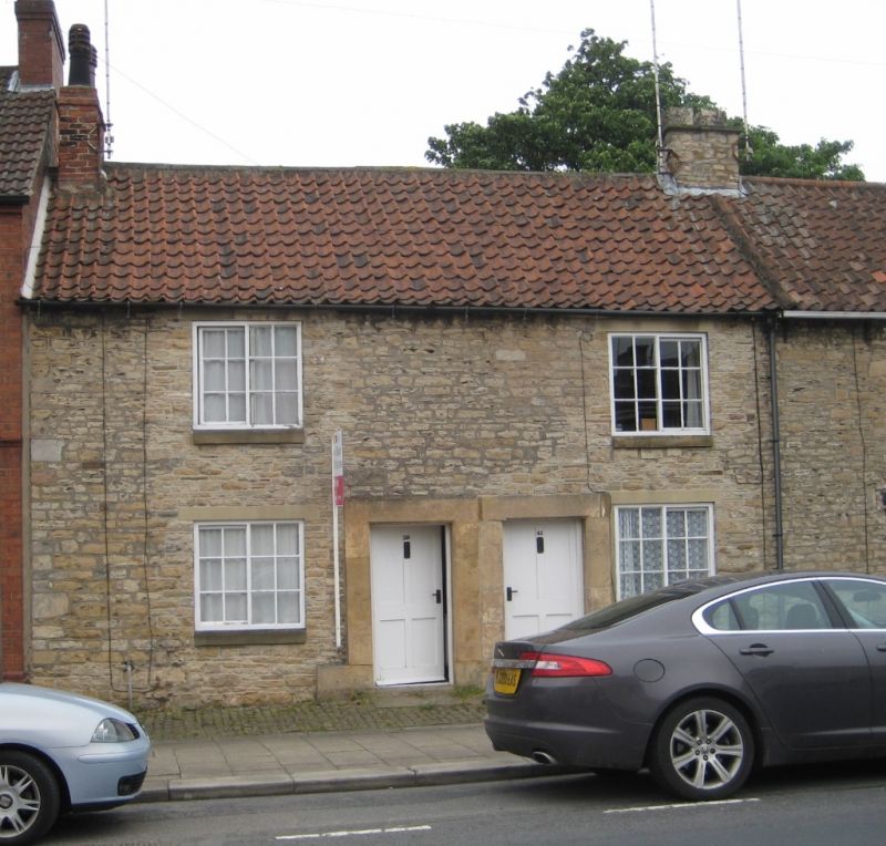
CASTLEGATE
1. (east side)
5096 -----------
Nos 39 and 41
SK 5993 2/66
II GV
2.
Cl8 or Cl9. Coursed rubble. Pantiled roof. Two storeys. Two bays: C19
casements. Doors with plain raised stone surrounds, chamfered.
Listing NGR: SK5929093038
External links are from the relevant listing authority and, where applicable, Wikidata. Wikidata IDs may be related buildings as well as this specific building. If you want to add or update a link, you will need to do so by editing the Wikidata entry.


Other nearby listed buildings
