Approximate Location Map
Large Map »
Latitude: 53.4794 / 53°28'45"N
Longitude: -1.1519 / 1°9'6"W
OS Eastings: 456380
OS Northings: 398408
OS Grid: SK563984
Mapcode National: GBR NXD6.DG
Mapcode Global: WHDD8.8TQ0
Plus Code: 9C5WFRHX+Q6
Entry Name: Range of farmbuildings and wall enclosing farmyard at White Cross Grange
Listing Date: 26 November 1987
Grade: II
Source: Historic England
Source ID: 1193466
English Heritage Legacy ID: 334852
ID on this website: 101193466
Location: Doncaster, South Yorkshire, DN11
County: Doncaster
Civil Parish: Wadworth
Traditional County: Yorkshire
Lieutenancy Area (Ceremonial County): South Yorkshire
Church of England Parish: Wadworth with Loversall
Church of England Diocese: Sheffield
Tagged with: Architectural structure
This list entry was subject to a Minor Amendment on 23 December 2021 to update text and reformat to current standards
SK59NE
5/78
WADWORTH
WHITE CROSS LANE (south side, off)
Range of farmbuildings and attached wall enclosing farmyard at White Cross Grange
GV
II
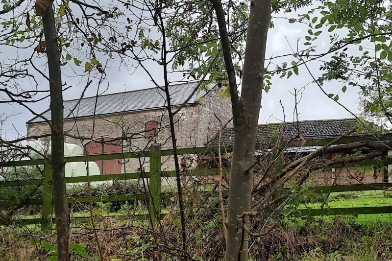
Planned range of farmbuildings with attached wall. c1860. Coursed, dressed magnesian limestone, stone-slate eaves courses to pantile roofs partly replaced in Welsh slate and sheet asbestos. Buildings set round three sides of farmyard on left of, and linked to rear of, White Cross Grange Farmhouse (q.v.); two-storey, five-bay barn to centre of rear range; two-storey, three-bay cowhouse with loft to centre of left side of yard;- the two-storey parts are linked by one-storey buildings and the front of the farmyard enclosed by contemporary wall, with gate piers, which returns next to the house and incorporates pig troughs.
Barn: central waggon entrance with boarded doors and segmental arch beneath loading hatch; slit vents to each side, inserted door on right; gable copings. Range to right has door flanked by slatted casements; return range has through-passage, doors and slatted casements and two open-fronted pigsties with internal covered yards; dairy at junction with house. Range to left of barn is blind (being a four-bay cartshed open to rear). Left return range has an open-fronted shelter shed with loose box on left. Central two-storey part has door flanked by slatted casements beneath segmental arches; another door on right has rounded arch with keystone and leads to internal stair; three slatted casements to first floor; eaves band, gable copings. One-storey range on left has a two-bay open-fronted shelter shed flanked by loose boxes each with door and window; gable copings-to end of range. Front wall has chamfered copings running to square gate piers with pyramidal caps; return section of wall, near dairy, has brick-arched pig troughs.
Well-preserved planned-farm group.
Listing NGR: SK5638098408
External links are from the relevant listing authority and, where applicable, Wikidata. Wikidata IDs may be related buildings as well as this specific building. If you want to add or update a link, you will need to do so by editing the Wikidata entry.


Other nearby listed buildings
