Approximate Location Map
Large Map »
Latitude: 53.457 / 53°27'25"N
Longitude: -1.2741 / 1°16'26"W
OS Eastings: 448294
OS Northings: 395824
OS Grid: SK482958
Mapcode National: GBR MXJG.YH
Mapcode Global: WHDDD.DCHN
Plus Code: 9C5WFP4G+Q8
Entry Name: Farmbuilding approximately 140 metres to north of Ravenfield Hall Farmhouse
Listing Date: 29 March 1968
Last Amended: 1 April 1987
Grade: II
Source: Historic England
Source ID: 1151870
English Heritage Legacy ID: 335959
ID on this website: 101151870
Location: Ravenfield, Rotherham, South Yorkshire, S65
County: Rotherham
Civil Parish: Ravenfield
Traditional County: Yorkshire
Lieutenancy Area (Ceremonial County): South Yorkshire
Church of England Parish: Ravenfield St James
Church of England Diocese: Sheffield
Tagged with: Agricultural structure
This list entry was subject to a Minor Amendment on 10 January 2022 to update text and reformat to current standards
SK49NE
1/84
RAVENFIELD
RAVENFIELD LANE (east side, off)
Farmbuilding approximately 140 metres to north of Ravenfield Hall Farmhouse
(Formerly listed as Ravenfield Hall Barn)
29.3.68
GV
II
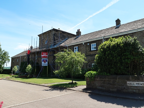
Combination farmbuilding. Mid-late C18. For the Ravenfield Hall estate. Coursed, squared sandstone, graduated slate roof. Three-storey, one-bay centre with two-storey, five-bay shelter shed with loft to west and barn to east. North side: large quoins; central part breaks forward and has round-headed window within round-arched panel; round-arched recess and band beneath tower with blind oculus and eaves cornice.
Barn on left: enlarged entrance to left with steel girder; slit vents in three rows; three oculi, that to right altered.
Shelter shed with loft on right: four basket-arched panels, that on right with door; rectangular panels over, the central two with iron-barred, square windows, the left panel with inserted door and external iron steps. Bay to far right has round-arched window to ground floor with similar blind opening over. Hipped roofs, tower has ball finial.
Rear of shelter shed with loft: arcade of four basket-arched openings beneath panels with slatted casements; door beneath two slatted casements on left. Central bay has bricked-up round arch beneath window and unglazed oculus.
Barn: slit vents, oculi and waggon entrance on right with wooden lintel and relieving arch.
Listing NGR: SK4829495824
External links are from the relevant listing authority and, where applicable, Wikidata. Wikidata IDs may be related buildings as well as this specific building. If you want to add or update a link, you will need to do so by editing the Wikidata entry.


Other nearby listed buildings
