Approximate Location Map
Large Map »
Latitude: 53.8005 / 53°48'1"N
Longitude: -1.761 / 1°45'39"W
OS Eastings: 415835
OS Northings: 433828
OS Grid: SE158338
Mapcode National: GBR JHH.D5
Mapcode Global: WHC98.XQLT
Plus Code: 9C5WR62Q+6H
Entry Name: 52-56, Hanover Square
Listing Date: 16 June 1975
Grade: II
Source: Historic England
Source ID: 1314404
English Heritage Legacy ID: 336533
ID on this website: 101314404
Location: Wapping, Bradford, West Yorkshire, BD1
County: Bradford
Electoral Ward/Division: Manningham
Parish: Non Civil Parish
Built-Up Area: Bradford
Traditional County: Yorkshire
Lieutenancy Area (Ceremonial County): West Yorkshire
Church of England Parish: Manningham St Paul and St Jude
Church of England Diocese: Leeds
Tagged with: Building
1.
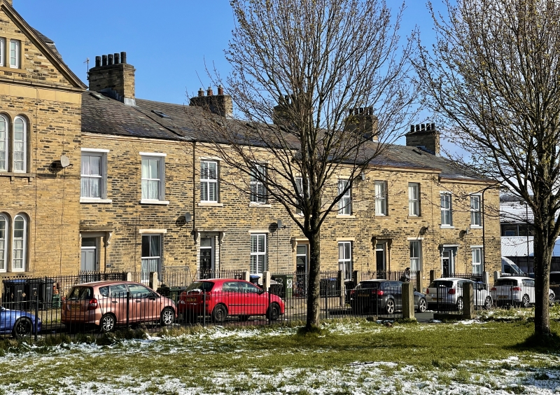
5111 HANOVER SQUARE
Nos 52 to 56 (consec)
SE 1533 34/156 16.6.75
II GV
2.
Circa 1840 similar 2-storey row, forming approach to square, as Nos 7 to 17. Coursed
gritstone. Two windows each. Doorways with cornices on console brackets. Included
for group value.
Listing NGR: SE1583533828
External links are from the relevant listing authority and, where applicable, Wikidata. Wikidata IDs may be related buildings as well as this specific building. If you want to add or update a link, you will need to do so by editing the Wikidata entry.


Other nearby listed buildings
