Approximate Location Map
Large Map »
Latitude: 51.3736 / 51°22'24"N
Longitude: 1.3085 / 1°18'30"E
OS Eastings: 630359
OS Northings: 169035
OS Grid: TR303690
Mapcode National: GBR WZW.TXN
Mapcode Global: VHLG5.MQLV
Plus Code: 9F3398F5+C9
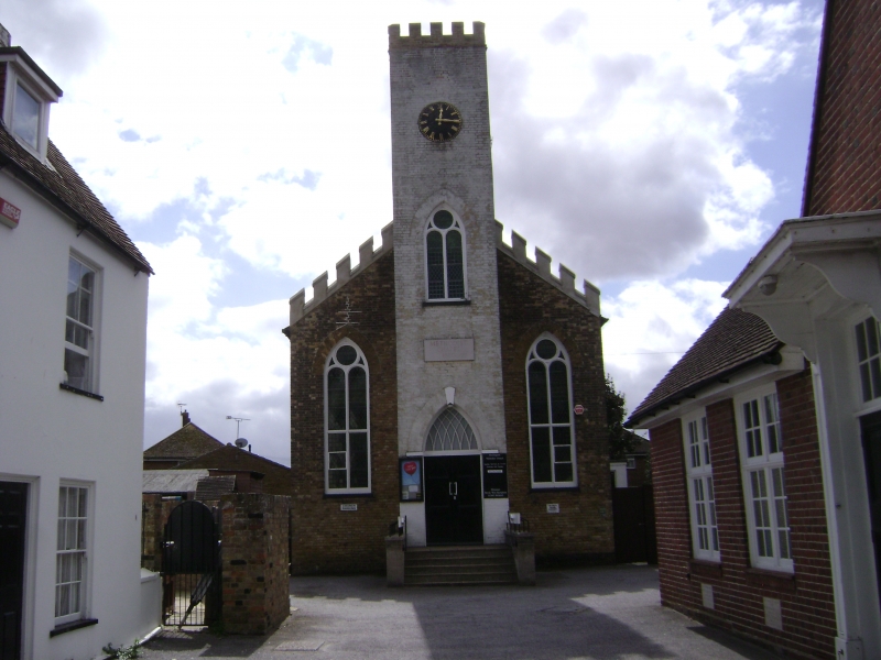
Entry Name: Birchington Methodist Chapel
Listing Date: 22 February 1987
Grade: II
Source: Historic England
Source ID: 1088986
English Heritage Legacy ID: 356495
ID on this website: 101088986
Location: Birchington, Thanet, Kent, CT7
County: Kent
District: Thanet
Civil Parish: Birchington
Built-Up Area: Margate
Traditional County: Kent
Lieutenancy Area (Ceremonial County): Kent
Tagged with: Chapel
CANTERBURY ROAD
1.
1380
(South Side)
BIRCHINGTON-ON-SEA
Birchington Methodist
Chapel
TR 36 NW 9/113
II
2.
Dated 1830. Stock brick with central crenellated clock tower. The other part
is also crenellated. 3 double lancets with traceried heads. Simple doorcase
having a pointed arch with 'Gothic' glazing. The side elevation has 3 windows.
Listing NGR: TR3035969035
External links are from the relevant listing authority and, where applicable, Wikidata. Wikidata IDs may be related buildings as well as this specific building. If you want to add or update a link, you will need to do so by editing the Wikidata entry.


Other nearby listed buildings
