Approximate Location Map
Large Map »
Latitude: 51.3991 / 51°23'56"N
Longitude: 0.1459 / 0°8'45"E
OS Eastings: 549374
OS Northings: 168857
OS Grid: TQ493688
Mapcode National: GBR R7.RFC
Mapcode Global: VHHP5.G3Z9
Plus Code: 9F3294XW+J9
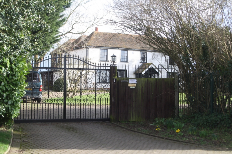
Entry Name: Hockenden House
Listing Date: 29 June 1973
Grade: II
Source: Historic England
Source ID: 1359330
English Heritage Legacy ID: 358495
ID on this website: 101359330
Location: Hockenden, Bromley, London, BR8
County: London
District: Bromley
Electoral Ward/Division: Cray Valley East
Parish: Non Civil Parish
Traditional County: Kent
Lieutenancy Area (Ceremonial County): Greater London
Church of England Parish: Cray Valley
Church of England Diocese: Rochester
Tagged with: House
HOCKENDEN LANE, ST PAUL'S CRAY
1.
4407
Hockenden House
TQ 46 NE 9/100
II
2.
C18. 2 parallel ranges. 2 storeys. 4 windows. Paced with weatherboarding.
3 hipped tiled roofs. Glazing bars intact on 1st floor only. C19 porch
with bargeboards.
Listing NGR: TQ4937468857
External links are from the relevant listing authority and, where applicable, Wikidata. Wikidata IDs may be related buildings as well as this specific building. If you want to add or update a link, you will need to do so by editing the Wikidata entry.


Other nearby listed buildings
