Approximate Location Map
Large Map »
Latitude: 52.7036 / 52°42'12"N
Longitude: -2.5203 / 2°31'13"W
OS Eastings: 364940
OS Northings: 311895
OS Grid: SJ649118
Mapcode National: GBR BV.2L8M
Mapcode Global: WH9D2.893P
Plus Code: 9C4VPF3H+CV
Entry Name: Parville House
Listing Date: 8 April 1983
Grade: II
Source: Historic England
Source ID: 1292509
English Heritage Legacy ID: 362422
ID on this website: 101292509
Location: Wellington, Telford and Wrekin, Shropshire, TF1
County: Telford and Wrekin
Civil Parish: Wellington
Built-Up Area: Telford
Traditional County: Shropshire
Lieutenancy Area (Ceremonial County): Shropshire
Church of England Parish: Wellington All Saints
Church of England Diocese: Lichfield
Tagged with: House
WELLINGTON CRESCENT ROAD
1.
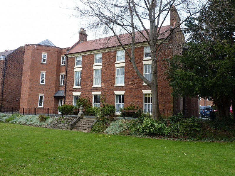
5362 Parville House
SJ 6411NE 4/570
II GV
2.
C18 red brick house. Machine tile roof with parapet gable ends. Moulded modillion
eaves cornice. Three-storeys. Four bays. Sashes with glazing bars, plain stone
lintels. At rear later stone porch with Tuscan columns and entablature.
Listing NGR: SJ6494011895
External links are from the relevant listing authority and, where applicable, Wikidata. Wikidata IDs may be related buildings as well as this specific building. If you want to add or update a link, you will need to do so by editing the Wikidata entry.


Other nearby listed buildings
