Approximate Location Map
Large Map »
Latitude: 51.7551 / 51°45'18"N
Longitude: -1.2557 / 1°15'20"W
OS Eastings: 451471
OS Northings: 206526
OS Grid: SP514065
Mapcode National: GBR 8YY.TLW
Mapcode Global: VHCXV.640W
Plus Code: 9C3WQP4V+2P
Entry Name: Trinity College, New Library
Listing Date: 12 January 1954
Grade: II
Source: Historic England
Source ID: 1230900
English Heritage Legacy ID: 405935
ID on this website: 101230900
Location: Oxford, Oxfordshire, OX1
County: Oxfordshire
District: Oxford
Electoral Ward/Division: Carfax
Parish: Non Civil Parish
Built-Up Area: Oxford
Traditional County: Oxfordshire
Lieutenancy Area (Ceremonial County): Oxfordshire
Church of England Parish: Oxford St Mary Magdalen
Church of England Diocese: Oxford
Tagged with: Library building
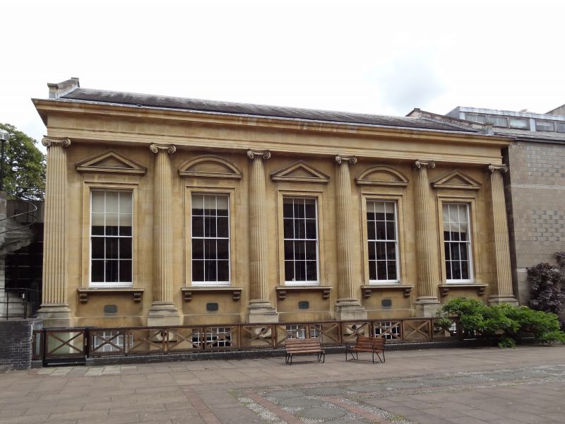
TRINITY COLLEGE
1.
1485
Front Quadrangle
New Library
SP 5106 NW 5/139F 12.1.54.
II
2.
1925-8 Palladian stone-faced on West, brick back on East. To designs of
J Osborne Smith, architect.
Listing NGR: SP5147106526
External links are from the relevant listing authority and, where applicable, Wikidata. Wikidata IDs may be related buildings as well as this specific building. If you want to add or update a link, you will need to do so by editing the Wikidata entry.


Other nearby listed buildings
