Approximate Location Map
Large Map »
Latitude: 50.94 / 50°56'23"N
Longitude: 0.6509 / 0°39'3"E
OS Eastings: 586337
OS Northings: 118958
OS Grid: TQ863189
Mapcode National: GBR QXL.WYM
Mapcode Global: FRA D67M.KC4
Plus Code: 9F22WMQ2+X8
Entry Name: The Parish Church of St Mary
Listing Date: 3 August 1961
Last Amended: 13 May 1987
Grade: I
Source: Historic England
Source ID: 1274500
English Heritage Legacy ID: 415040
ID on this website: 101274500
Location: St Mary's Church, Rother, East Sussex, TN31
County: East Sussex
District: Rother
Civil Parish: Udimore
Traditional County: Sussex
Lieutenancy Area (Ceremonial County): East Sussex
Church of England Parish: Udimore St Mary
Church of England Diocese: Chichester
Tagged with: Church building
TQ 81 NE UDIMORE RYE ROAD
24/12 The Parish Church of
St Mary
3.8.61 (Formerly listed as
Church of St Mary)
I
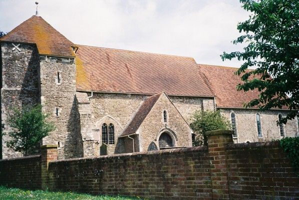
Chancel, nave, south porch and west tower. Nave Norman, chancel and tower C13.
Listing NGR: TQ8634018960
External links are from the relevant listing authority and, where applicable, Wikidata. Wikidata IDs may be related buildings as well as this specific building. If you want to add or update a link, you will need to do so by editing the Wikidata entry.


Other nearby listed buildings
