Approximate Location Map
Large Map »
Latitude: 51.2776 / 51°16'39"N
Longitude: 1.079 / 1°4'44"E
OS Eastings: 614838
OS Northings: 157665
OS Grid: TR148576
Mapcode National: GBR TY2.X6S
Mapcode Global: VHLGM.N48X
Plus Code: 9F3373HH+2H
Entry Name: 5 and 6, St Margaret's Street
Listing Date: 3 May 1967
Grade: II
Source: Historic England
Source ID: 1242063
English Heritage Legacy ID: 441194
ID on this website: 101242063
Location: Canterbury, Kent, CT1
County: Kent
District: Canterbury
Electoral Ward/Division: Westgate
Parish: Non Civil Parish
Built-Up Area: Canterbury
Traditional County: Kent
Lieutenancy Area (Ceremonial County): Kent
Tagged with: Building
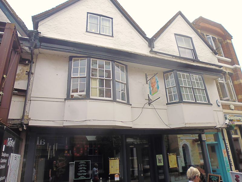
1.
944 ST MARGARET'S STREET
(South East Side)
Nos 5 & 6
TR 1457 NE 4/193 3.5.67.
II GV
2.
Early C17. 2 storeys and gables. Timber-framed but now plastered on 1st
floor with painted brick in the gables. Restored tiled roof. Gables have
2 C19 windows. 1 casement and 1 sash with verticals only, Overhang. 2 canted
bays, 1 3-light, 1 4-light. Later C19 shopfront.
Nos 5 to 8 (consec) form a group.
Listing NGR: TR1484457660
External links are from the relevant listing authority and, where applicable, Wikidata. Wikidata IDs may be related buildings as well as this specific building. If you want to add or update a link, you will need to do so by editing the Wikidata entry.


Other nearby listed buildings
