Approximate Location Map
Large Map »
Latitude: 51.6693 / 51°40'9"N
Longitude: -0.6881 / 0°41'17"W
OS Eastings: 490818
OS Northings: 197540
OS Grid: SU908975
Mapcode National: GBR F65.6VW
Mapcode Global: VHFSG.191N
Plus Code: 9C3XM896+PP
Entry Name: Barn Attached to and to North East of Holmer Green Farmhouse
Listing Date: 13 September 1977
Grade: II
Source: Historic England
Source ID: 1332435
English Heritage Legacy ID: 44479
ID on this website: 101332435
Location: Holmer Green, Buckinghamshire, HP15
County: Buckinghamshire
Civil Parish: Little Missenden
Built-Up Area: High Wycombe
Traditional County: Buckinghamshire
Lieutenancy Area (Ceremonial County): Buckinghamshire
Church of England Parish: Penn Street
Church of England Diocese: Oxford
Tagged with: Barn
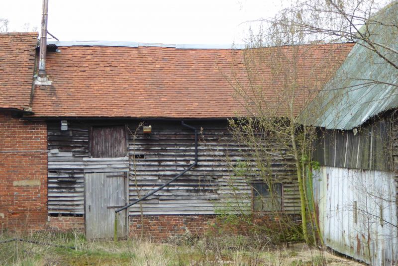
LITTLE MISSENDEN PENFOLD LANE
1.
5134
Holmer Green
Barn attached to and
to north-east of
Holmer Green Farmhouse
SU 99 NW 3/35 13.9.77
II GV
2.
Perhaps C17, but now essentially C18. Timber framed. Weather boarded, old
tile roof.
Listing NGR: SU9081897540
External links are from the relevant listing authority and, where applicable, Wikidata. Wikidata IDs may be related buildings as well as this specific building. If you want to add or update a link, you will need to do so by editing the Wikidata entry.


Other nearby listed buildings
