Approximate Location Map
Large Map »
Latitude: 51.0688 / 51°4'7"N
Longitude: -1.7961 / 1°47'46"W
OS Eastings: 414380
OS Northings: 129956
OS Grid: SU143299
Mapcode National: GBR 517.W5Z
Mapcode Global: FRA 7649.62V
Plus Code: 9C3W3693+GG
Entry Name: The Poultry Cross
Listing Date: 28 February 1952
Grade: I
Source: Historic England
Source ID: 1243148
English Heritage Legacy ID: 446674
Also known as: Poultry Cross (Salisbury)
Poultry Cross, Salisbury
ID on this website: 101243148
Location: Salisbury, Wiltshire, SP1
County: Wiltshire
Civil Parish: Salisbury
Built-Up Area: Salisbury
Traditional County: Wiltshire
Lieutenancy Area (Ceremonial County): Wiltshire
Church of England Parish: Salisbury St Thomas and St Edmund
Church of England Diocese: Salisbury
Tagged with: Market cross Shelter Shelter
SILVER STREET
1.
1594 (North Side)
The Poultry Cross
SU 1429 NW 3/327 28.2.52.
I GV
2.
Standing at the Junction of Minster and Silver Streets.
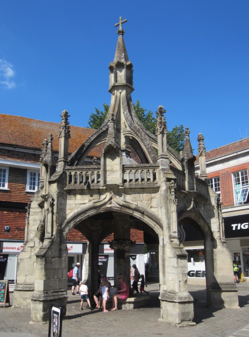
C14. Hexagonal open arched shelter with buttressed piers enriched with carved
and panelled pinnacles.
The arches are flat segmental shaped and moulded with drip turned up in a point
over centre rind under base of a carved and pinnacled niche.
A central stone shaft with a stone seat round at the base, is carried up through
a lead roof and originally finished with a sundial block.
Some enthusiastic stonemason of local importance and envious of a similar cross
at Chichester, added a series of flying buttresses meeting in the centre and
covering the sundial and topped with a hexagonal block with a niche on each
face, crowned with a pinnacle and cross.
All the upper addition is C19 though well done of its kind.
The cross was originally surrounded by a square of stone seats which have now
been removed.
Drawings exist in the Museum showing original state. AM.
The Poultry Cross and Nos 36 to 52 (even) form a group. No 36 forms a group
with Nos 1 to 17 (odd) Minster Street qv the rear elevations of which form a
group with those of Nos 36 to 52 (even) and with St Thomas's Church,
St Thomas's Square qv.
Listing NGR: SU1438029956
External links are from the relevant listing authority and, where applicable, Wikidata. Wikidata IDs may be related buildings as well as this specific building. If you want to add or update a link, you will need to do so by editing the Wikidata entry.


Other nearby listed buildings
