Approximate Location Map
Large Map »
Latitude: 52.4601 / 52°27'36"N
Longitude: -2.7407 / 2°44'26"W
OS Eastings: 349771
OS Northings: 284944
OS Grid: SO497849
Mapcode National: GBR BJ.L5Z8
Mapcode Global: VH83Q.FFZF
Plus Code: 9C4VF765+3P
Entry Name: 9, Lower Corfton
Listing Date: 15 March 1974
Grade: II
Source: Historic England
Source ID: 1269861
English Heritage Legacy ID: 460320
ID on this website: 101269861
Location: Corfton, Shropshire, SY7
County: Shropshire
Civil Parish: Diddlebury
Traditional County: Shropshire
Lieutenancy Area (Ceremonial County): Shropshire
Church of England Parish: Diddlebury
Church of England Diocese: Hereford
Tagged with: Building
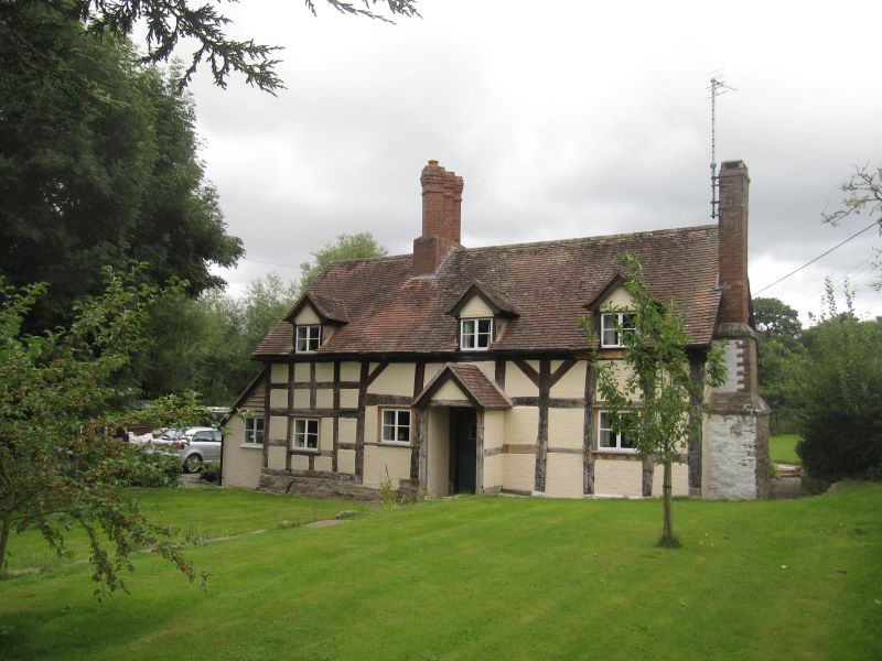
DIDDLEBURY
SO48SE CORFTON
1943-1/1/29 No.9 Lower Corfton
15/03/74
GV II
House. C17. Timber-frame and brick; plain tile roof; C20
restored cross axial brick ridge stack with diagonally set
triple shafts; C20 brick end stack.
EXTERIOR: single-storey and attic: central entrance with C20
plank door and gabled porch; three 2-light casements; 3 gabled
dormers with 2-light casements. Lean-to.
INTERIOR: not inspected.
Listing NGR: SO4977184944
External links are from the relevant listing authority and, where applicable, Wikidata. Wikidata IDs may be related buildings as well as this specific building. If you want to add or update a link, you will need to do so by editing the Wikidata entry.


Other nearby listed buildings
