Approximate Location Map
Large Map »
Latitude: 52.2118 / 52°12'42"N
Longitude: 0.1153 / 0°6'55"E
OS Eastings: 544621
OS Northings: 259176
OS Grid: TL446591
Mapcode National: GBR L78.CY4
Mapcode Global: VHHK2.YN9S
Plus Code: 9F426468+P4
Entry Name: Castle Brae
Listing Date: 2 November 1972
Grade: II
Source: Historic England
Source ID: 1111884
English Heritage Legacy ID: 47398
ID on this website: 101111884
Location: Cambridge, Cambridgeshire, CB4
County: Cambridgeshire
District: Cambridge
Electoral Ward/Division: Arbury
Parish: Non Civil Parish
Built-Up Area: Cambridge
Traditional County: Cambridgeshire
Lieutenancy Area (Ceremonial County): Cambridgeshire
Church of England Parish: Cambridge The Ascension
Church of England Diocese: Ely
Tagged with: Building
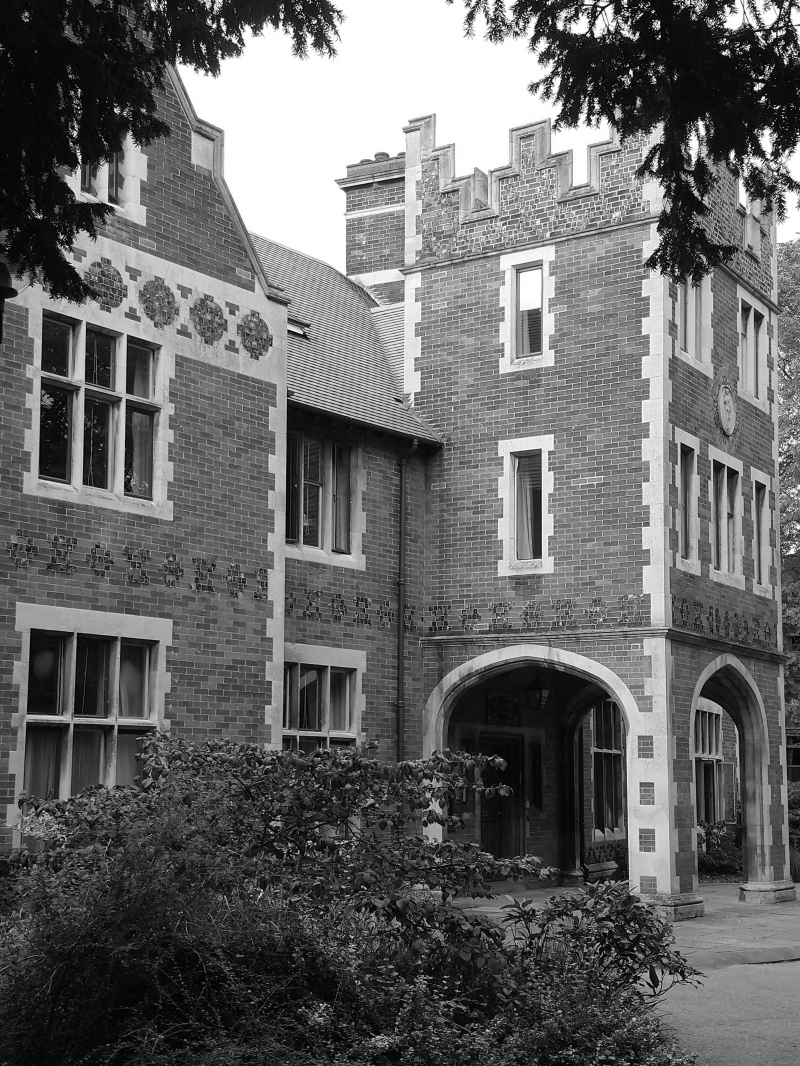
CHESTERTON LANE
1.
942
No 5
(Castle Brae)
TL 4459 15/461
II
2.
Mid/Late C19. In the Tudor style. Red brick with stone dressings and
blue brick decorations. 2 storeys and attic. 3 and 5-light mullion and
transom windows. Projecting porch. Tiled roof.
Listing NGR: TL4462159176
External links are from the relevant listing authority and, where applicable, Wikidata. Wikidata IDs may be related buildings as well as this specific building. If you want to add or update a link, you will need to do so by editing the Wikidata entry.


Other nearby listed buildings
