Approximate Location Map
Large Map »
Latitude: 50.8215 / 50°49'17"N
Longitude: -0.1402 / 0°8'24"W
OS Eastings: 531096
OS Northings: 104087
OS Grid: TQ310040
Mapcode National: GBR JP4.FC4
Mapcode Global: FRA B6LX.P66
Plus Code: 9C2XRVC5+HW
Entry Name: The Pump House Tavern
Listing Date: 20 August 1971
Grade: II
Source: Historic England
Source ID: 1381767
English Heritage Legacy ID: 482131
ID on this website: 101381767
Location: Brighton, Brighton and Hove, West Sussex, BN1
County: The City of Brighton and Hove
Electoral Ward/Division: Regency
Parish: Non Civil Parish
Built-Up Area: Brighton and Hove
Traditional County: Sussex
Lieutenancy Area (Ceremonial County): East Sussex
Church of England Parish: Brighton The Chapel
Church of England Diocese: Chichester
Tagged with: Pub
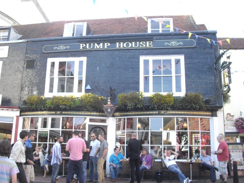
BRIGHTON
TQ3104SW MARKET STREET
577-1/64/492 (West side)
20/08/71 Nos.44, 45 AND 46
The Pump House Tavern
II
Houses, now shops and a tavern, the whole known as "The Pump
House". Late C18 or early C19 fronting of a building which may
be earlier; restored since 1980. Mathematical tile, stucco to
short right return. Roof of tile.
EXTERIOR: 2 storeys over basement. One window each. The ground
floor of each has a full-width, segmental-bay shop front. The
original glazing bars and spandrels of each removed in a
recent restoration. Tuscan pilasters frame each bay and
support an entablature with modillioned cornice which is
continuous across all 3 shops. There is tripartite,
first-floor window to each, that to No.44 being a reproduction
of an original late C18 or early C19 design. All openings are
flat arched. Low parapet with metal coping. One roof dormer to
each. Single entrance to return. The stack to left wall of
No.44 is brick and has been much rebuilt in the late C20.
Another stack in the end wall of No.46 with parapet wall
stretching to rear half of building.
INTERIOR: not inspected.
The name was applied to a building on this site at least as
early as 1776 and may derive from the town well which stood
not far away on the Knab, now known as Brighton Place.
(Carder T: The Encyclopaedia of Brighton: Lewes: 1990-: 115E
AND 115M).
Listing NGR: TQ3109604087
External links are from the relevant listing authority and, where applicable, Wikidata. Wikidata IDs may be related buildings as well as this specific building. If you want to add or update a link, you will need to do so by editing the Wikidata entry.


Other nearby listed buildings
