Approximate Location Map
Large Map »
Latitude: 54.4877 / 54°29'15"N
Longitude: -3.183 / 3°10'58"W
OS Eastings: 323461
OS Northings: 510905
OS Grid: NY234109
Mapcode National: GBR 6J6K.P2
Mapcode Global: WH70S.2GKJ
Plus Code: 9C6RFRQ8+3R
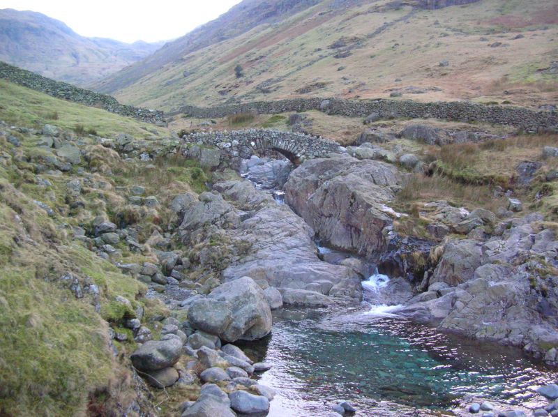
Entry Name: Stockley Bridge
Listing Date: 8 August 1985
Grade: II
Source: Historic England
Source ID: 1107901
English Heritage Legacy ID: 72143
ID on this website: 101107901
Location: Cumberland, Cumbria, CA12
County: Cumbria
District: Allerdale
Civil Parish: Borrowdale
Traditional County: Cumberland
Lieutenancy Area (Ceremonial County): Cumbria
Church of England Parish: Borrowdale St Andrew
Church of England Diocese: Carlisle
Tagged with: Bridge Footbridge Packhorse bridge
NY 21 SW BORROWDALE SEATHWAITE
19/59 Stockley Bridge
II
Packhorse bridge. Early or mid C18. Slate rubble. Narrow single-span
humped-back bridge, with split-slate voussoirs under low parapet. Shown on a
lithograph by William Green in 1814.
Listing NGR: NY2346110905
External links are from the relevant listing authority and, where applicable, Wikidata. Wikidata IDs may be related buildings as well as this specific building. If you want to add or update a link, you will need to do so by editing the Wikidata entry.


Other nearby listed buildings
