Approximate Location Map
Large Map »
Latitude: 53.2912 / 53°17'28"N
Longitude: -1.6672 / 1°40'1"W
OS Eastings: 422280
OS Northings: 377193
OS Grid: SK222771
Mapcode National: GBR JZSC.VW
Mapcode Global: WHCCV.CJBQ
Plus Code: 9C5W78RM+F4
Entry Name: Mompessons Well at SK 223 772
Listing Date: 12 July 1967
Grade: II
Source: Historic England
Source ID: 1347936
English Heritage Legacy ID: 80649
Also known as: Mompesson's Well at SK 223 772
ID on this website: 101347936
Location: Eyam, Derbyshire Dales, Derbyshire, S32
County: Derbyshire
District: Derbyshire Dales
Civil Parish: Eyam
Traditional County: Derbyshire
Lieutenancy Area (Ceremonial County): Derbyshire
Church of England Parish: Eyam St Lawrence
Church of England Diocese: Derby
Tagged with: Well
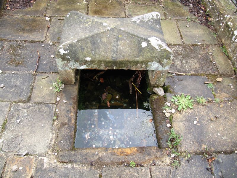
SK 27 NW PARISH OF EYAM EDGE ROAD
4/41 (West Side)
12-7-67 Mompesson's Well at SK223772
II
Wellhead. C17. Gritstone. Stone trough, covered to west by rectangular slab
crossed by humped ribs. Surrounded by C20 iron railings. Listed for historical
association with the Eyam plague of 1666.
Listing NGR: SK2228077192
External links are from the relevant listing authority and, where applicable, Wikidata. Wikidata IDs may be related buildings as well as this specific building. If you want to add or update a link, you will need to do so by editing the Wikidata entry.


Other nearby listed buildings
