Approximate Location Map
Large Map »
Latitude: 50.726 / 50°43'33"N
Longitude: -3.5305 / 3°31'49"W
OS Eastings: 292071
OS Northings: 92937
OS Grid: SX920929
Mapcode National: GBR P1.8L25
Mapcode Global: FRA 37H5.8D4
Plus Code: 9C2RPFG9+CR
Entry Name: Rougemont Castle
Listing Date: 29 January 1953
Grade: I
Source: Historic England
Source ID: 1104054
English Heritage Legacy ID: 88901
ID on this website: 101104054
Location: Rougemont Gardens, Exeter, Devon, EX4
County: Devon
District: Exeter
Electoral Ward/Division: St David's
Parish: Non Civil Parish
Built-Up Area: Exeter
Traditional County: Devon
Lieutenancy Area (Ceremonial County): Devon
Church of England Parish: Central Exeter
Church of England Diocese: Exeter
Tagged with: Castle
CASTLE STREET
1.
1092
(North End)
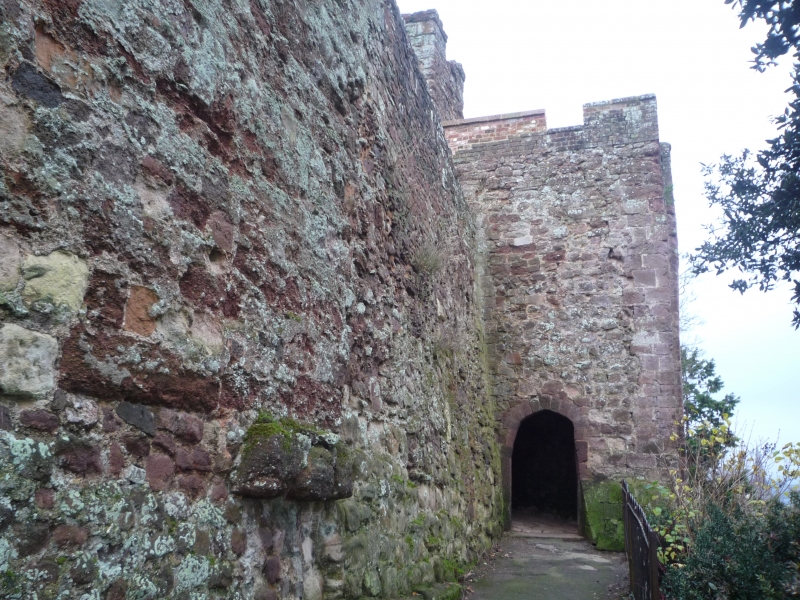
Rougemont Castle
SX 9392 NW 3/410
SX 9293 12/410 29.1.53
I GV
2.
Norman. Walls, Aethelstan's Tower and the Gate Tower. The last is much restored.
AM.
All the listed buildings in Castle Street form a group.
Listing NGR: SX9207192937
External links are from the relevant listing authority and, where applicable, Wikidata. Wikidata IDs may be related buildings as well as this specific building. If you want to add or update a link, you will need to do so by editing the Wikidata entry.


Other nearby listed buildings
